2014 Western Section of the Wildlife Society Meeting wrap-up

I recently attended the 2014 annual meeting of the Western Section of the Wildlife Society in Reno CA. The focus of the conference was on harnessing citizen science toward greater conservation.

I saw some interesting talks in my session (I was clearly the odd-talk-out in a session dominated by animal tracking (I spoke about our SNAMP website evaluation)). For example:

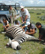
  • Peter Bloom discussed red-tailed hawk movements from banded bird recovery. The birds are banded as juveniles and observed by citizens and scientists. In this way their movements can be mapped: across southern California, across the Pacific flyway, and across the US.
  • Joe Burnett presented on the use of GSM transmitters to track California condor (the largest flying bird in north America) movement patterns. He caught us up on condor recovery and current threats (lead poisoning from foraging on wild game) to condors. He showed some very nice visualizations of wild condor flights between Ventana and the Pinnacles (including some stops for water and dead animal chomping) from the GSM transmitters and Google Earth. 
  • Shannon Rich looked at migration patterns of flammulated owls using light-level geolocators. "What is a flammulated owl”? you say: I will tell you. They are super cute tiny owls, with neat flame-like markings on their face and body. Geolocators are small (~1g) that record ambient light levels during the day, and from timing of sunrise and sunset, you can get latitude and longitude. These are not sending out signals, and you need to recapture the owl to download data. As always, I am stunned by the dedication and time it takes for wildlife biologists to gather their careful data on animal movement.
  • Russ Bryant talked about native honeybee habitat in North Dakota. He talked about the important services that bees give us: 95 agricultural plants benefit from pollination services (estimated at $15b). I did not know that ND is the top honey producer in the US. Colony collapse across the US has been profound. They used INVEST to explore the role of land cover and bee pollination to produce a pollinator habitat index, and a habitat connectivity for areas where bees had been captured. 

In the climate change session, I heard from a range of speakers on practical adaptation strategies, curriculum for climate change education (Whitney Albright), new tools and reports for grassland bird species conservation (Ryan Diguadio), landscape-scale conservation planning for bobcats in the San Diego area (Megan Jennings), and some neat genetics of the SF Bay’s salt marsh harvest mouse (Mark Statham). Also, Curtis Alling talked about local, regional and state climate preparedness planning, and dedicated a slide to cal-adapt.org. Nice!

I also got to catch up briefly with ESPM grads Sarah Sawyer who is now at the Forest Service and Tim Bean, who is thriving at HSU. Alice, he suggested a trip up to Redwood State Park to check out the dark figure of crime in the tall trees. 

map of global routes of ship-borne invasive species

From the BBC. Scientists have developed the first global model that analyses the routes taken by marine invasive species. The researchers examined the movements of cargo ships around the world to identify the hot spots where these aquatic aliens might thrive. The research is published in the Journal Ecology Letters.

Scientists mapped the global routes taken by cargo ships over a two-year period

Marine species are taken in with ballast water on freighters and wreak havoc in new locations, driving natives to extinction.

There has been a well-documented boom in global shipping over the past 20 years and this has led to growing numbers of species moving via ballast tanks, or by clinging to hulls.

Some ports such as San Francisco and Chesapeake Bay have reported several exotic new species arriving every year. Economic estimates indicate that marine invaders can have huge impacts that last for decades.

Now, scientists from the UK and Germany have developed a model that might help curb these unwanted visitors. They obtained detailed logs from nearly three million voyages that took place in 2007 and 2008. The model combines information such as shipping routes, ship sizes, temperatures and biogeography to come up with local forecasts of invasion probabilities.

corridor analysis tools

Alan shared a link with me for Corridor Design. It includes downloads for various GIS Tools, overviews of corridor concepts, and reports on linkage designs. The stated goal is "to transfer everything we've learned about designing wildlife corridors to the general public to facilitate better conservation, science, and dialogue."  Check out the site's blog for info on their latest projects.

Mapping Traffic’s Toll on Wildlife

Roadkill and participatory GIS (two of my favorite topics) make it mainstream! A recent article from the New York Times describes a project out of UC Davis using citizen observers to map roadkill.

"Volunteers comb the state’s highways and country roads for dead animals, collecting GPS coordinates, photographs and species information and uploading it to a database and Google map populated with dots representing the kills. The site’s gruesome gallery includes photos of flattened squirrels or squashed skunks."

The project website can be found here: http://www.wildlifecrossing.net/california/

Read the NY times article here.

Researching why animals move across the land

Collaring a zebraA very nice article about Wayne Getz's research in Africa: spatial ecology, epidemiology, conservation and citizen science. From Breakthroughs Magazine

In this article he talks about his evolution as a scientist from mathematician to geo-nerd. The article states: At the core of Getz’s work is how and why animals move across the land. People have sought answers to these questions for time immemorial - at first to improve success in the hunt and harvest, and much later to understand animals in and of themselves. His approach combines a mathematician’s genius for analysis with hands-on wildlife research. This unique perspective is revealing that animal travel patterns can provide a great number of insights into animal behavior, ecology, and epidemiology.

And now the GIS part: In recent years, the advent of global positioning system technologies, coupled with expanded telecommunications networks, have added up to a revolution in animal tracking. The modern version of the radio collar can map an animal’s position to within a couple of meters every few minutes, upload the stored data automatically to a satellite or cell phone network, and allow biologists to track the beast from afar for many weeks. 

Also read about his work in education and social justice in South Africa. Cool stuff. Check it.