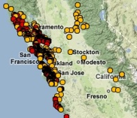
Holiday collection: fun sites from the end of 2008 (and Maya Lin at the De Young!)

So many site, so little space. So here's my wrap-up from G.reader on the cool stuff floating around at the end of the year (Many from the Map Room blog, a wonderful font of mapping information).

  • Boston Globe's Year in Maps article. This has some lovely examples of new cartography. Maybe Tim can start one of these at the Chicago Trib next year!
  • NASA's gorgeous and simple Global Fire Map. I like the simplicity and effectiveness of these maps.
  • Sean Gordon's wrap up of user-created maps online is an interesting read.
  • Kind of gross yet cool: Mapping Rats in NY.

And last, but by no means least, if you are lucky enough to live in the bay area, and have an interest in maps/mapping/representations of landscapes, go to Maya Lin's exhibit "Systematic Landscapes" at the De Young. It is mesmerizing, fascinating, charming and thought-provoking at the same time. I just loved it. It is on through the 18th, so get on it!!!!

OakMapper 2.0 released

Hi y'all. The new OakMapper 2.0 is up and running, and we'd like your help in mapping areas of oak mortality around the state. Version 2.0 improves upon the website's prior version with increased functionality and additional tools within an easily navigated interface.  Launched by the UC Berkeley Kelly lab in October, OakMapper 2.0 makes it easier for users to explore data, download maps, look at images of oak mortality, and submit suspected locations of oak mortality that may be associated with SOD.  The new interface utilizes the familiar background layers and navigation tools from Google Maps.  Users are able to draw points and polygons directly on the map as well as attach photos to specific points.  The Kelly lab encourages the public to use this site to map suspected cases of SOD and to track their submission by signing up for an account with OakMapper.  Registered users of the site can update their information and make comments on other users' points.  Official confirmations of P. ramorum are clearly separated from community-submitted points and either set of points can be filtered out.The new OakMapper is found at oakmapper.org.  Please consider signing up to be an OakMapper user! The OakMapper was recently featured in the recent journal of the Bay Area Automated Mapping Association

.

LiDAR and 3″-4″ ortho files of Contra Costa County available!

I went to the Contra Costa Countywide GIS meeting yesterday and found out about these countywide files that were recently posted to the Casil FTP site in the coco-county folder. Infrared imagery is expected to be posted by January 2009. The LiDAR was flown for flood control analysis, but it is publicly available for any other research. The county GIS deptartment asks that you contact them to share how you work with the data. Also, I came across this LiDAR resources site with links to other data and helpful info.

KML in Research Competition | Bring your data to life

Google Earth has launched a competition for KML in research, check it out Google is constantly looking for new ways to spur innovation and creativity in science and engineering. We are looking for the best examples of showing your work in Google Earth using KML. And we'll reward the brightest scientists, researchers, and students from all over the world. In addition to prizes, winning entries will be showcased on the Google Earth website and at our booth at the 2008 American Geophysical Union convention

.

GoodGuide.com: Dara’s Talk Today

From Dara O'Rourke's colloquium today. He went over the new site GoodGuide. Aside from scoring your favorite products based on health, environmental and social scores, they also provide a new tool to look at political support by companies. Check this out: major companies classified by their political donations. Some very revealing information for us consumers! And Burt's Bees is really Clorox? Man is this greenwashing complicated.

New York Times Data Visualization Lab

So I have to admit, the last two days I've spent about 8hrs playing with the 20+  visualizations on NYT online. I also just saw they launched their own website  NYT Data Visualization Lab And users can access this to create their own visualizations. The potential for this Flash style graphics with GIS is endless, it would be great to see a Flash+GIS product out there.  The New York Times is clearly leading this march, it will be interesting to watch it develop. Cheers, Josh

Rad! Mapping Manhattan Project

Manhattan in 1609 Eric Sanderson is visiting CNR next week: Chris G pointed me to his work. Imagining Manhattan before European contact through visualization. Gorgeous work, and appealing on many levels for geographers everywhere.  Project site, and highlights from the New Yorker.  The image here shows an aerial view of Manhattan as it might have looked in 1609, juxtaposed with the outline of Manhattan today.

Pollan is at it again

By "it" I mean brilliantly explaining the food situation. Read his Open Letter to the Next President from Sunday's NYTimes; and listen to him on Fresh Air (10-20-08 podcast).  He touches on everything we talked about in lab meeting last week - ethanol, cheap calories, obesity, GHG, growing biofuels on prime agricultural land, farmer's disincentives to grow food. This guy is amazing.

Measuring Your Food Environment

This site is related to the work Ellen and I are working on with Barbara Laraia and Irene Yen at UCSF. We are mapping the food environment for a study collaborating with Kaiser examining obesity and diabetes rates.  This is a new-ish field, with lots of new and exciting methods being developed to map access to "good" and "bad" food.  The National Cancer Institute has developed a site that collects many of these approaches.