TanDEM-X and TerraSAR-X cover the globe
/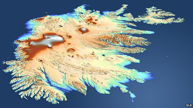 TanDEM's view of Iceland: The country was beyond the sight of the shuttle topography mission in 2000We talked about TanDEM before, after launch. The German satellite radar twins - TanDEM-X and TerraSAR-X - are a year through their quest to make the most precise, seamless map of varying height on Earth.
They've now acquired data across the entire globe at least once. However, some tricky sampling areas, such as tall mountains and thick forests, will require several passes and so we don't expect to see a fully finished product before 2014.
As compared with the Shuttle product at best spatial resolution of 30m by 30m, and a vertical resolution that varies from 16m to 10m, the intention of the TanDEM mission is to go down to a spatial resolution of 12m by 12m and a vertical resolution of 2m. Airbone lidars can achieve much better precision, but these maps are necessarily regional in extent - they will cover only relatively small areas. The purpose of TanDEM is to build a world DEM that is single-source and has "no joins".
Report from the BBC here.
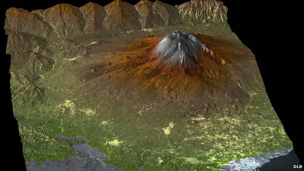 The TanDEM Digital Elevation Model of Mount Etna, Sicily, Italy