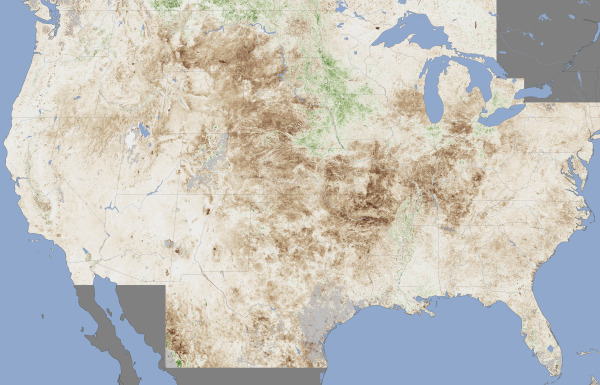
Drought imagery from MODIS
/As the warm weather moves west this week we think about those battling the drought in the midwest and northern states. Here is a shot from July from NASA's Moderate Resolution Imaging Spectroradiometer (MODIS) sensor, on the Terra satellite. The map contrasts plant health in the United States between June 25 and July 10, 2012, against the average conditions between 2002 and 2012. Brown areas show where plant growth was less vigorous than normal; cream colors depict normal levels of growth; and green indicates abnormally lush vegetation. Data was not available in the gray areas due to snow or cloud cover. From NASA.