SNAMP spatial recommendations: Lidar + accurate veg maps needed for forest management
/The SNAMP UC Science Team worked together to develop 31 integrated management recommendations at the conclusion of our SNAMP project. The following deal specifically with lidar and vegetation mapping. All 31 can be found here. All our SNAMP spatial publications can be found here.
Mapping forests for management
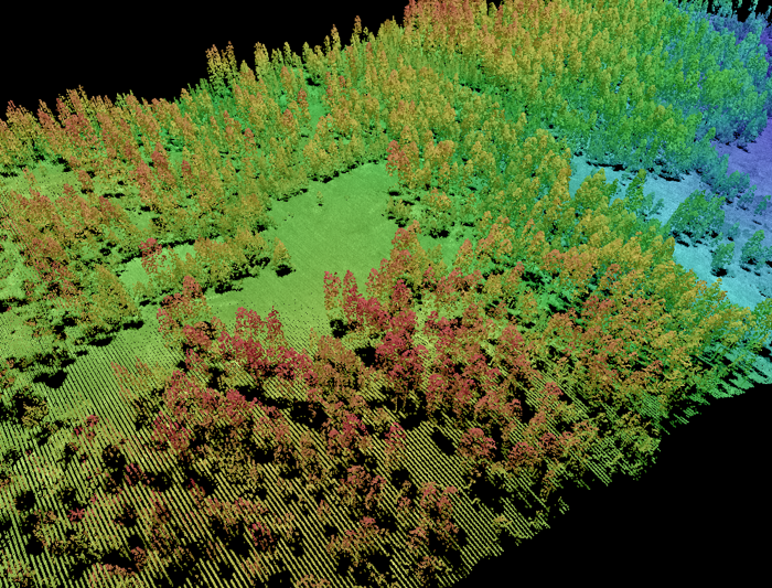 Lidar point cloud forest stand: Marek Jakubowski
If your goal is to integrate across firesheds, an accurate vegetation map is essential, and a fusion of optical, lidar and ground data is necessary.
Lidar data can produce a range of mapped products that in many cases more accurately map forest height, structure, and species than optical imagery alone. Our work indicated that the combination of high-resolution multi-spectral aerial/satellite imagery with lidar is very helpful in mapping vegetation communities as well as characterizing forest structure zones.
If your goal is to understand the effects of SPLATs, lidar is essential to accurately monitor the intensity and location of SPLAT treatments.
Lidar data can effectively penetrate the forest canopy and can be used to accurately detect forest understory changes. Our work indicated that the use of lidar-derived vegetation structure products (e.g., canopy cover and vegetation height) significantly outperformed the aerial image in identifying the SPLAT treatment extent and intensity.