Wrap up from the Esri Imagery and Mapping Forum
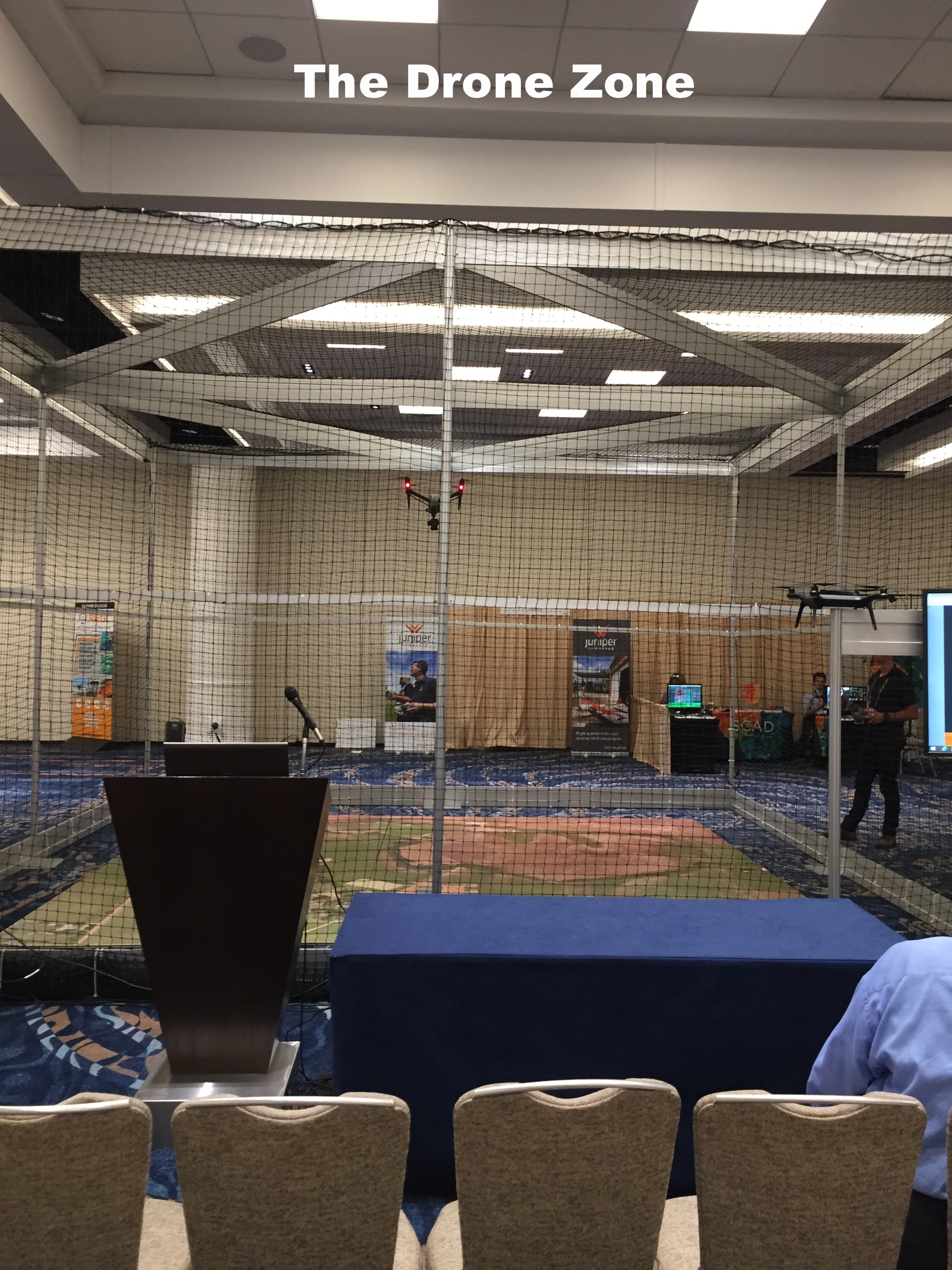
/Recently, Esri has been holding an Imagery and Mapping Forum prior to the main User Conference. This year I was able to join as an invited panelist for the Executive Panel and Closing Remarks session on Sunday. During the day I hung out in the Imaging and Innovation Zone, in front of the Drone Zone (gotta get one of these for ANR). This was well worth attending: smaller conference - focused topics - lots of tech reveals - great networking.
Notes from the day: Saw demos from a range of vendors, including:
- Aldo Facchin from Leica gave a slideshow about the Leica Pegasus: Backpack. Their backpack unit workflow uses SLAM; challenges include fusion of indoor and outdoor environments (from transportation networks above and below ground). Main use cases were industrial, urban, infrastructure. http://leica-geosystems.com/en-us/products/mobile-sensor-platforms/capture-platforms/leica-pegasus-backpack
- Jamie Ritche from Urthecast talked about "Bringing Imagery to Life". He says our field is "a teenager that needs to be an adult". By this he means that in many cases businesses don't know what they need to know. Their solution is in apps- "the simple and the quick": quick, easy, disposable and useful. 4 themes: revisit, coverage, time, quality. Their portfolio includes DEIMOS 1, Theia, Iris, DEIMOIS-2, PanGeo + . Deimos-1 focuses on agriculture. UrtheDaily: 5m pixels, 20TB daily, (40x the Sentinel output); available in 2019. They see their constellation and products as very comparable to Sentinel, Landsat, RapidEye. They've been working with Land O Lakes as their main imagery delivery. Stressing the ability of apps and cloud image services to deliver quick, meaningful information to users. https://www.urthecast.com/
- Briton Vorhees from SenseFly gave an overview of: "senseFly's Drone Designed Sensors". They are owned by Parrot, and have a fleet of fixed wing drones (e.g. the eBee models); also drone optimized cameras, shock-proof, fixed lens, etc (e.g. SODA). These can be used as a fleet of sensors (gave an citizen-science example from Zanzibar (ahhh Zanzibar)). They also use Sequoia cameras on eBees for a range of applications. https://www.sensefly.com/drones/ebee.html
- Rebecca Lasica and Jarod Skulavik from Harris Geospatial Solutions: The Connected Desktop". They showcased their new ENVI workflow implemented in ArcGIS Pro. Through a Geospatial Services Framework that "lifts" ENVI off the desktop; and creates an ENVI Engine. They showed some interesting crop applications - they call it "Crop Science". This http://www.harrisgeospatial.com/
- Jeff Cozart and McCain McMurray from Juniper Unmanned shared "The Effectiveness of Drone-Based Lidar" and talked about the advantages of drone-based lidar for terrain mapping and other applications. They talked through a few projects, and highlighted that the main advantages of drone-based lidar are in the data, not in the economics per se. But the economies do work out too. (They partner with Reigl and YellowScan from France.) They showcased an example from Colorado that compared lidar (I think it was a Reigl on a DJI Matrice) and traditional field survey - the lidar cost was 1/24th as expensive as the field survey. They did a live demo of ArcGIS tools with their CO data: classification of ground, feature extraction, etc. http://juniperunmanned.com/
- Aerial Imaging Productions talked about their indoor scanning - this linking-indoor-to-outdoor (i.e. making point cloud data truly geo) is a big theme here. Also OBJ is a data format. (From Wikipedia: "The OBJ file format is a simple data-format that represents 3D geometry alone — namely, the position of each vertex, the UV position of each texture coordinate vertex, vertex normals, and the faces that make each polygon defined as a list of vertices, and texture vertices.") It is used in the 3D graphics world, but increasingly for indoor point clouds in our field.
- My-Linh Truong from Riegl talked about their new static, mobile, airborne, and UAV lidar platforms. They've designed some mini lidar sensors for smaller UAVas (3lbs; 100kHz; 250m range; ~40pts/m2). Their ESRI workflow is called LMAP, and it relies on some proprietary REIGL software processing at the front end, then transfer to ArcGIS Pro (I think). http://www.rieglusa.com/index.html
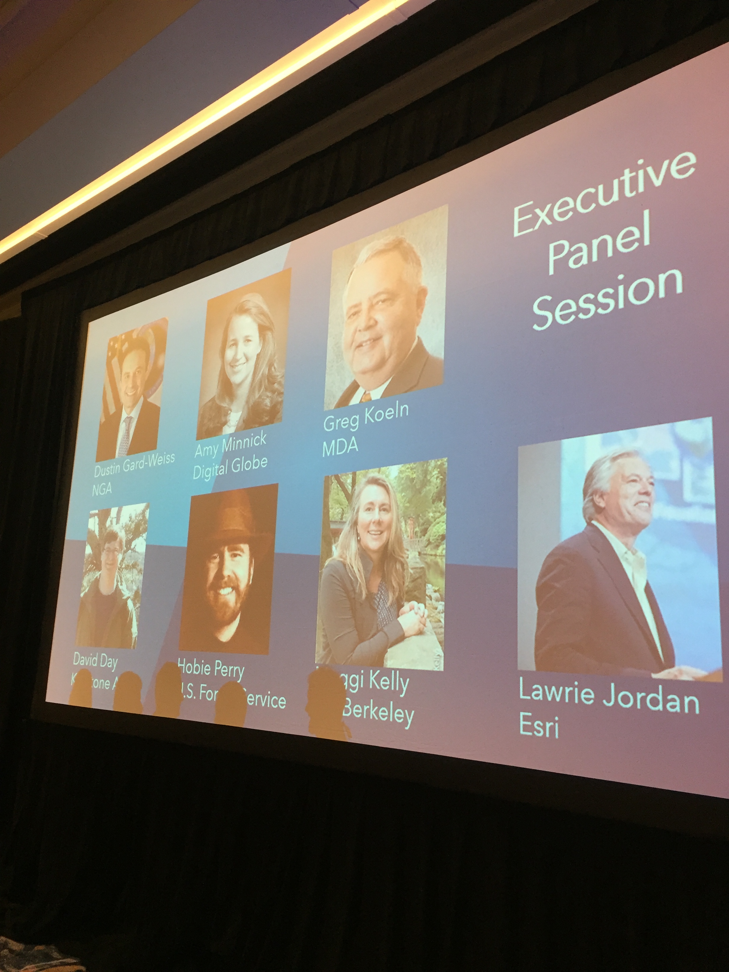
We wrapped up the day with a panel discussion, moderated by Esri's Kurt Schwoppe, and including Lawrie Jordan from Esri, Greg Koeln from MDA, Dustin Gard-Weiss from NGA, Amy Minnick from DigitalGlobe, Hobie Perry from USFS-FIA, David Day from PASCO, and me. We talked about the promise and barriers associated with remote sensing and image processing from all of our perspectives. I talked alot about ANR and IGIS and the use of geospatial data, analysis and viz for our work in ANR. Some fun things that came out of the panel discussion were:
- Cool stuff:
- Lawrie Jordan started Erdas!
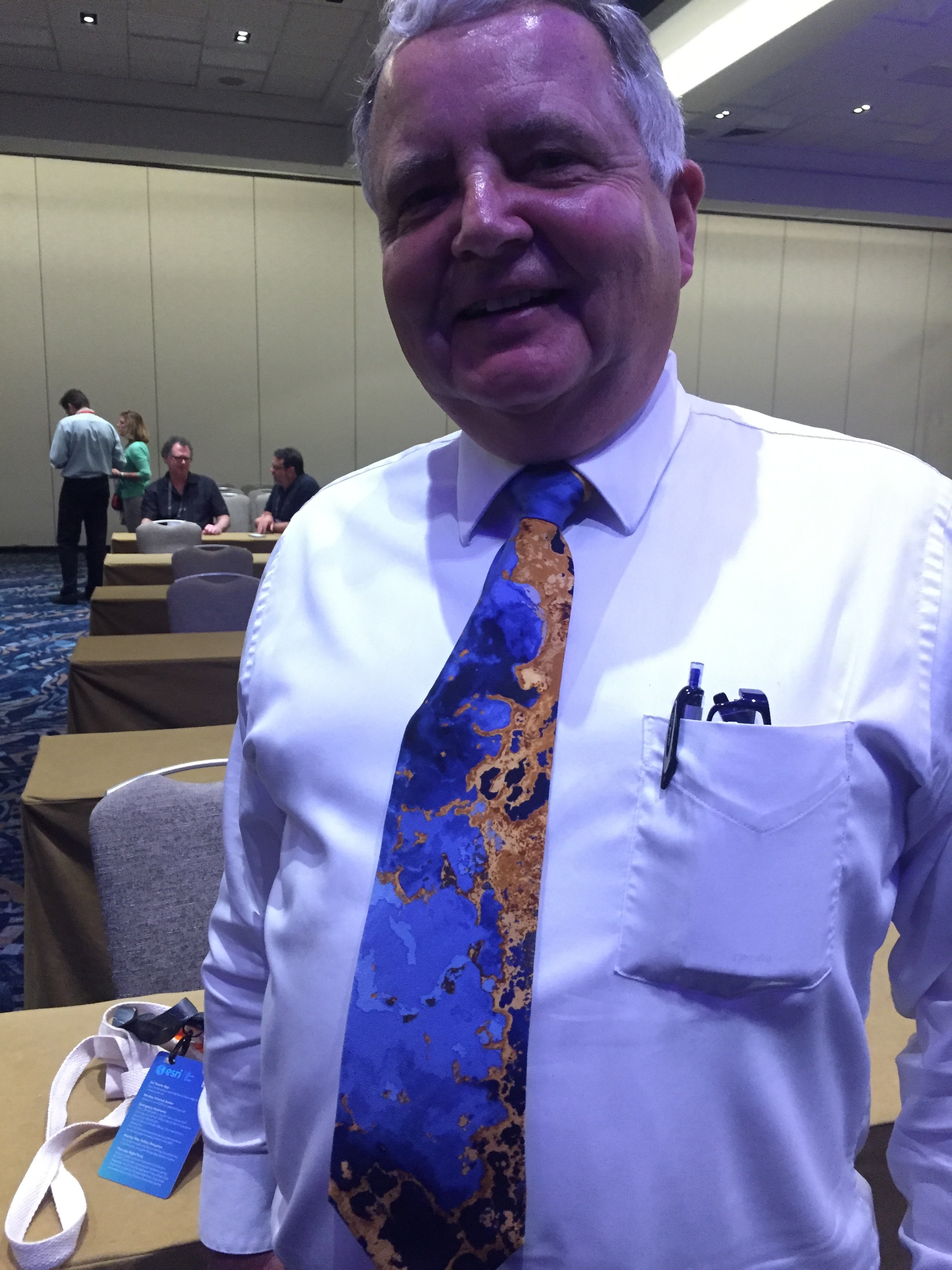
- Greg Koeln wears Landsat ties (and has a Landsat sportcoat).
- Digital Globe launched their 30cm resolution WorldView-4. One key case study was a partnership with Associated Press to find a pirate fishing vessel in action in Indonesia. They found it, and busted it, and found on board 2,000 slaves.
- The FIA is increasingly working on understanding uncertainty in their product, and they are moving for an image-base to a raster-based method for stratification.
- Greg Koeln, from MDA (he of the rad tie- see pic below) says: "I'm a fan of high resolution imagery...but I also know the world is a big place".
- Challenges:
- We all talked about the need to create actionable, practical, management-relevant, useful information from the wealth of imagery we have at our fingertips: #remotesensible.
- Multi-sensor triangulation (or georeferencing a stack of imagery from multiple sources to you and me) is a continual problem, and its going to get worse before it gets better with more imagery from UAVs. On that note, Esri bought the patent for "SIFT" a Microsoft algorithm to automate the relative registration of an image stack.
- Great question at the end about the need to continue funding for the public good: ANR is critical here!
- Space Junk.
- Game-changers:
- Opening the Landsat archive: leading to science (e.g. Hansen et al. 2013), leading to tech (e.g. GEE and other cloud-based processors). Greg pointed out that in the day, his former organization (Ducks Unlimited) paid $4,400 per LANDSAT scene to map wetlands nationwide! That's a big bill.
- Democratization of data collection: drones, smart phones, open data...

The panel in action
Notes and stray thoughts:
- Esri puts on a quality show always. San Diego always manages to feel simultaneously busy and fun, while not being crowded and claustrophobic. Must be the ocean, the light and the air.
- Trying to get behind the new "analytics" replacement of "analysis" in talks. I am not convinced everyone is using analytics correctly ("imagery analytics such as creating NDVI"), but hey, it's a thing now: https://en.wikipedia.org/wiki/Analytics#Analytics_vs._analysis
- 10 years ago I had a wonderful visitor to my lab from Spain - Francisco Javier Lozano - and we wrote a paper: http://www.sciencedirect.com/science/article/pii/S003442570700243X. He left to work at some crazy startup company called Deimos in Spain, and Lo and Behold, he is still there, and the company is going strong. The Deimos satellites are part of the UrtheCast fleet. Small world!
- The gender balance at the Imagery portion of the Esri UC is not. One presenter at a talk said to the audience with a pointed stare at me: "Thanks for coming Lady and Gentlemen".
Good fun! Now more from Shane and Robert at the week-long Esri UC!