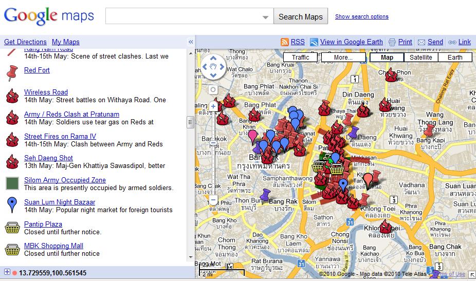
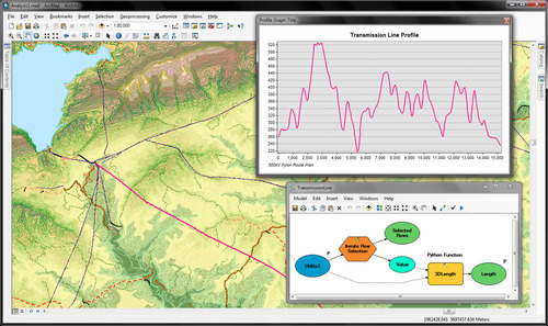
ArcGIS.com online mapping now available

ESRI has just launched a public beta version of their online mapping service on arcgis.com

At the ArcGIS.com site, you can browse featured ArcGIS Online content such as maps and applications published by ESRI and the ArcGIS community, and add comments and ratings. You can upload and share your own items, either with specific groups that you created or are a member of, or you can share your items publicly. Use the newly designed Web Mapping application to quickly create online mashups that you can also share with others.

The design and interface is nicely done, and includes easy access to many of ESRI's online basemaps.  This site launch coencides with a greatly updated version of ArcGIS Explorer which provides a much improved free GIS viewer, tightly integrated with ArcGIS desktop layers and outputs.

 

First in new fleet of GPS satellites launches May 27, finally

The GPS IIF artworkMay is a big month for GPS. Ten years ago selective availability of GPS signals was disabled, making accurate GPS technology available to the public rather than just the U.S. military. Boy was field work hard back then - all that map reading!

And this week the Air Force will launch the first of the next generation of GPS satellites - the IIF SV-1. The new satellites each transmit three civilian GPS signals — we’ve typically been making do with just one for years — including a military-strength transmission that should enable autopilots to land with zero visibility. This means always-on GPS that’s accurate to within 3 feet, even indoors and in concrete urban canyons. From Wired.

According to the launch material, each IIF satellite will deliver:

  • Two times greater predicted signal accuracy than heritage satellites;
  • New L5 signals for more robust civil, commercial aviation;
  • Military signal "M-code" and variable power for better resistance to jamming in hostile environments;
  • A 12-year design life providing long-term service and reduced operating costs; and
  • An on-orbit, reprogrammable processor, receiving software uploads for improved system operation.

More information here.

Oil Spill Monitoring

A nonprofit called Skytruth has been monitoring the growing oil spill in the Gulf of Mexico using NASA/MODIS satellite imagery and publishing daily reports and analysis as the situation develops. They've also developed an interactive mapping site (Gulf Oil Spill Tracker site) where people can share photos or videos. Here is an example of one of the images they've produced:


 http://www.skytruth.org/

ArcGIS 10 coming in June

The latest ArcGIS release, ArcGIS 10, is slated to become available in June with a lot of big updates.  Check out ESRI's website to see more about what's coming.  They have several informative videos that demo the new software. 

Some of the improvements listed include:

  • Faster display, smoother navigation, and the ability to run geoprocessing in the background.
  • Perform in 3D virtually everything you can do in a 2D environment: modeling, editing, visualization, and analysis.
  • Simplify map creation and production with streamlined sketch-based Desktop (2D/3D) and Web editing.
  • Use and manage imagery more efficiently on the desktop and on the server.
  • New image analysis window for image interpretation and processing.
  • Automate common tasks and analyses with Python scripting.


NAIP 2009 Color Infrared Released

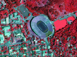
NAIP Color infrared, June 19, 2009Color Infrared imagery acquired during the summer of 2009 are now available for download from Cal-Atlas.  An index shapefile to identify the location of each image can be downloaded here (ZIP - 727KB).

The National Agriculture Imagery Program (NAIP) is tasked with providing access to high-resolution aerial image data on a state-by-state basis. 

These images are 1 meter resolution, 4 band GeoTIFFs that contain all of the natural color and infrared channels. 

Direct links to all of the California NAIP products are maintained on the GIF's website.  Currently, NAIP data is available for both 2005 and 2009.

Google Earth Browser Plugin

A union of Google Earth and Google Map took place yesterday (4/26/2010) resulting in Earth view. To be able to see the Earth view, you need to install the Google Earth browser plugin. From the LatLong Blog:

Those of you who aren’t as familiar with Google Earth might be wondering how Earth view differs from the satellite view that’s currently available in Maps. First of all, Earth view offers a true three-dimensional perspective, which lets you experience mountains in full detail, 3D buildings, and first-person dives beneath the ocean. The motion is fluid, and you can see the world from any viewpoint. Because Earth view is built right into Maps, you can switch back to cartographic view simply by clicking on the “Map” button. The view will even adjust automatically to a top-down, north-heading perspective as you transition. In essence, you now have all the best mapping tools at your fingertips, all in one place.

Today we are proud to announce the next major step in the marriage between Google Earth and Google Maps -- Earth view.

Smarter Suggest Feature for Google Maps

I tried out the smarter Suggest feature for Google Maps using my home address with mixed feelings. Because the search box is so responsive, some of the suggestions seemed very random as I typed my address. It also gave a list of shops and services, which made me wonder if this was more of an advertising scheme. Why don't you go ahead and try it out and see how you like it? Go to the same ole Google map address: maps.google.com.

The Suggest feature for Google Maps helps you find what you want faster and more accurately by showing search suggestions for the most relevant places, businesses and points of interest as you type. We experimentally launched suggest for Google Maps in Germany, China, Hong Kong and Taiwan a while ago. Since then, we’ve been working hard to improve the quality and coverage.

So from today we’re making the feature available on 10 more domains and in 8 additional languages, including English and on maps.google.com for the first time.

from Google LatLong Blog

New: Geospatial Modelling Environment

If you're a fan of Hawth's tools, be sure to check out SpatialEcology.com's latest product, Geospatial Modelling Environment.

"It combines the power of the statistical software R with the geographic processing functionality of ESRI ArcGIS to drive geospatial analyses.

"It incorporates most of the functionality of its predecessor, HawthsTools, but with some important improvements. It has a greater range of analysis and modelling tools, supports batch processing, offers new graphing functionality, automatically records work-flows for future reference, supports geodatabases, and can be called programatically." - http://www.spatialecology.com/gme/

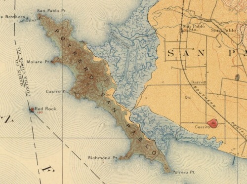
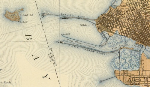
Lovely geologic quads of SF Bay - 1914

This is the bay bridge plan... Goat Island is Treasure Is., there was a narrow gauge railway from Oakland for shipments to SF and beyond.The repository interface with integrated Yahoo! Maps was developed by the Digital Initiatives -- Research & Technology group within the TAMU Libraries using the Manakin interface framework on top of the DSpace digital repository software.

Geologic Atlas of the United States by Texas A & M University Libraries is licensed under a Creative Commons Attribution 3.0 United States License.

Lightweight UAV Camera System Demo

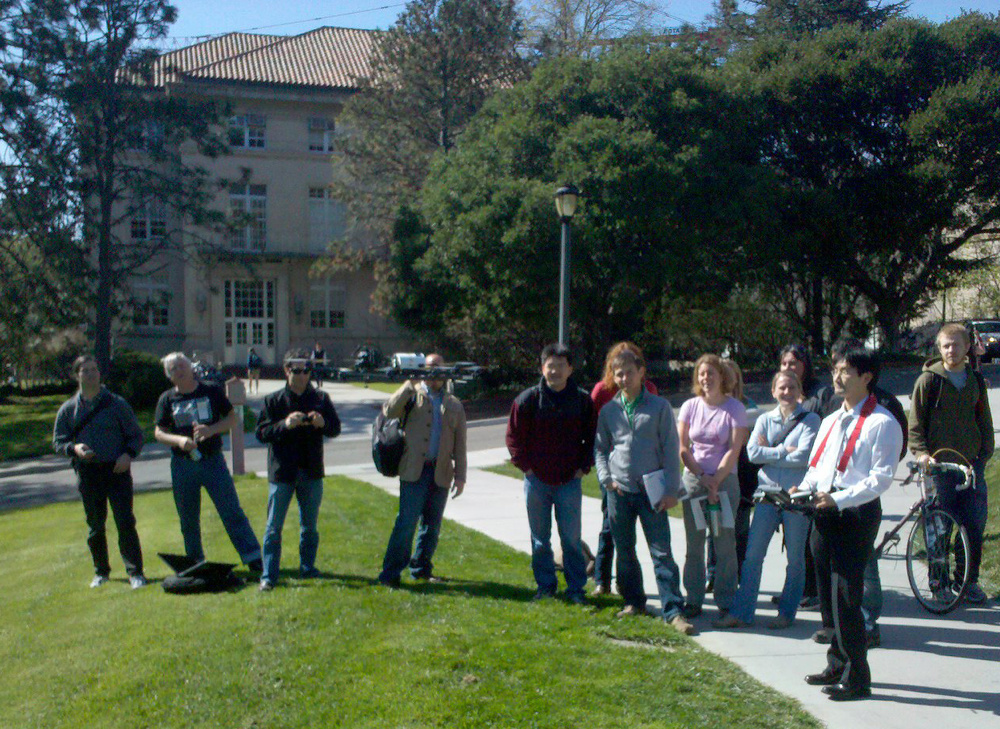
Yasuyuki launches the remotely controlled UAVWe enjoyed a fun Geolunch presentation yesterday, where Ben Burford of ISTS America and Yasuyuki Watabe and Masaki Usami from ISTS Japan showed off a new aerial photography system.  

This lightweight camera system is able to capture centimeter resolution image data at a fraction of the weight and cost of a traditional aerial photography system.  They’ve also developed software that can automatically orthorectify these acquired images with only the photos, gps location of the camera, and camera information. 

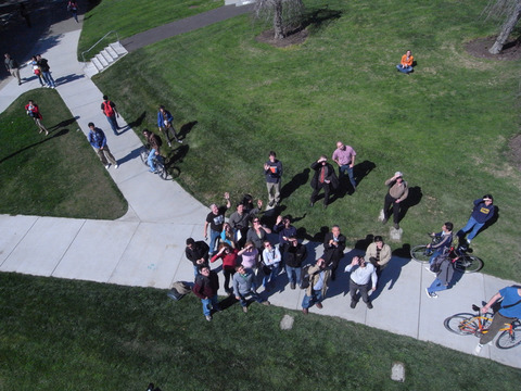
After presenting their systems capabilities in a slideshow presentation, the developers showed off their UAV with a live demo outside of Mulford Hall! 

Photo of onlookers taken from the UAV (photo compliments of Yasuyuki Watabe)

 You can view ISTS's promotional video here:


casablanca: the google earth prototype

I am so glad someone wrote this up! I was watching Casablanca (1942!) again awhile back, and just loved the intro scene of the earth, europe, and the route from Paris to Casablanca. This blog ((E)Space&Fiction: spatial machinery of fiction) (cool name, right?) makes the case that it was the first proto google earth, and analyzes the technical specifics that presaged Keyhole, etc. Specifically:

  • the combination of the spinning globe with a zoom effect on a specific point: Paris;
  • the use of a “jump” effect similar to Google Earth to move from one place (Paris) to another (Casablanca); and
  • the perspective changes from the vertical view to an oblique perspective of the streets of Casablanca, similar to current street views.

california map society website

The California Map Society has just launched a cool new website.  I am a member, I like these guys and their message. They say it well:

We are passionate about all phases of cartography in its broadest sense. We are fascinated by the potential of remote sensing, GIS, and the tools for today’s digital mapmaking. Yet we love the art and history embodied in antique maps. Understanding man’s continuing change in perception of his environment and world is part of the fun of viewing old maps. And we never fail to delight in the curious forms that maps have taken over the centuries.

Check out the website here.

California Coastal LiDAR Project (CCLP) to be available later this year

The California Coastal LiDAR Project (CCLP) is a collaborative effort to produce high-resolution topography data from Oregon to Mexico, extending from the shoreline up to the 10 m topographic contour. The U.S. Army Corps of Engineers (USACE) began a coastal aerial LiDAR collection in October 2009 as part of the National Coastal Mapping Program (NCMP). A combined effort by NOAA and USGS was developed in the latter half of 2009 to conduct LiDAR surveys of the San Francisco Bay Area extending from the Carquinez Strait to outside of the Golden Gate. The two projects are expected to be completed by mid-2010. Datasets will become publicly available by the end of 2010.

http://www.opc.ca.gov/webmaster/ftp/pdf/opc_cclp_report_final.pdf

http://www.opc.ca.gov/2010/01/mapping-californias-coastal-areas/

The volunteer mappers who helped Haiti

Using an image slideshow, BBC News tells the story of how volunteer mappers used OpenStreetMap, an open source mapping platform, to construct a detailed map of Port au Prince in Haiti with layers of geographic information. The geographic information was accessed and used by the rescue personel on the ground. This short slideshow highlights the importance of PPGIS/webGIS, mobile GIS, open source/platform, crowdsourcing, and public participation in a critical situation like the rescue effort in Haiti.

To view the slideshow, please click here.

Orthorectifying for the Masses

In a bit of Tom Sawyer-inspired app making, the New York Public Library has created an online application for rectifying their collection of digital maps of New York City. "Finding control points is so much fun! It is truly an honor to allow you, our special internet browser, to assist us in collecting them." The NYPL Map Rectifier allows you to export the rectified maps as KMLs. They've also added a separate section for maps of Haiti to assist in earthquake relief.