Google Maps border becomes part of international dispute

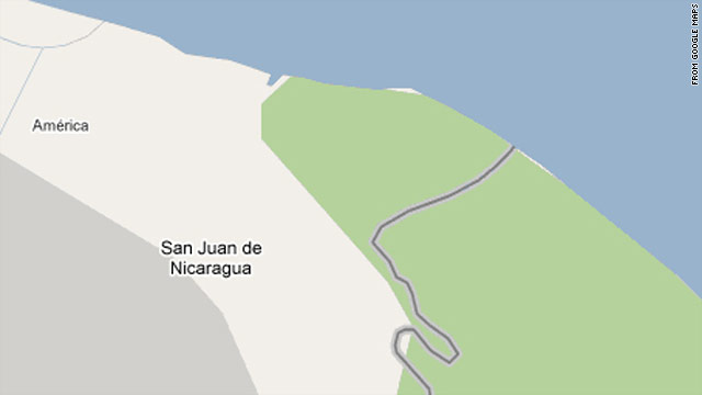
(CNN) -- The accuracy of Google Maps has been pulled into a debate about the border between two Central American countries.

A Nicaraguan general cited Google's version of the border map as an after-the-fact justification of a reported raid of a disputed area between that country and Costa Rica.

http://www.cnn.com/2010/TECH/web/11/05/nicaragua.raid.google.maps/index.html

Maps as Media: Map making in the 21st century

Today's "On the Media" radio show included a great discussion of maps and map making in the Google era. Largely a synopsis of this article in the Washington Monthly by John Gravois, the radio piece, with John Gravois, touched on the decline of the National Map and the rise of the Google Map paradigm, and the consequences of this change: how does Google name features that are in dispute? what do maps mean as their lineage changes from government to corporation? how do the political nuances of national maps change as Google becomes the global standard for map making? do we need a new term for these increasingly community based collections of spatially tagged conversations? It was a really interesting piece, and I recommend it. Good listening.

Google Earth Browser Plugin

A union of Google Earth and Google Map took place yesterday (4/26/2010) resulting in Earth view. To be able to see the Earth view, you need to install the Google Earth browser plugin. From the LatLong Blog:

Those of you who aren’t as familiar with Google Earth might be wondering how Earth view differs from the satellite view that’s currently available in Maps. First of all, Earth view offers a true three-dimensional perspective, which lets you experience mountains in full detail, 3D buildings, and first-person dives beneath the ocean. The motion is fluid, and you can see the world from any viewpoint. Because Earth view is built right into Maps, you can switch back to cartographic view simply by clicking on the “Map” button. The view will even adjust automatically to a top-down, north-heading perspective as you transition. In essence, you now have all the best mapping tools at your fingertips, all in one place.

Today we are proud to announce the next major step in the marriage between Google Earth and Google Maps -- Earth view.

Smarter Suggest Feature for Google Maps

I tried out the smarter Suggest feature for Google Maps using my home address with mixed feelings. Because the search box is so responsive, some of the suggestions seemed very random as I typed my address. It also gave a list of shops and services, which made me wonder if this was more of an advertising scheme. Why don't you go ahead and try it out and see how you like it? Go to the same ole Google map address: maps.google.com.

The Suggest feature for Google Maps helps you find what you want faster and more accurately by showing search suggestions for the most relevant places, businesses and points of interest as you type. We experimentally launched suggest for Google Maps in Germany, China, Hong Kong and Taiwan a while ago. Since then, we’ve been working hard to improve the quality and coverage.

So from today we’re making the feature available on 10 more domains and in 8 additional languages, including English and on maps.google.com for the first time.

from Google LatLong Blog

Disaster response evolves: faster, more detailed, and community focused

The recent earthquake in Haiti makes us, placed as we are on another of the great faults of the western hemisphere, take pause and think about the fragility of life and the suddenness of disasters like earthquakes.  The mapping of earthquakes - their shake strength, fault lines, and past seismicity - and their damage, has changed in recent years. The Haiti quake shows this: within hours and days of the quake, we were able to see the shake intensity, historical seismicity and detailed faults from the USGS, and Open Street Map opened up a crisis center for participatory mapping. International agencies requested satellite data of the area and, NASA, GeoEye and the European Space Agency responded, and shared their imagery freely.  A number of detailed before and after visualizations from outlets like the NY Times and Bing Maps quickly followed. The disaster and the geospatial response was chronicled in many blogs. 

This is more than what was available to us recently with the San Diego, California fires or the San Francisco Oil Spill in 2007, or Hurricane Katrina in 2005, or the Indian Ocean Tsunami in 2004, each of which set new records for mapping speed and creativity. Each global-scale disaster seems to be a driving innovative force to help shape and evolve participatory mapping, detailed imagery delivery, and spatial decision support tools.  For example, this past weekend I was involved in a World Bank effort called Operation GEO-CAN – Global Earth Observation – Catastrophe Assessment Network (press release here) to analyze aerial imagery from imagery from Port au Prince in 2009 (top) and 2010 (bottom)before and after the Haiti earthquake.  The World Bank needed fast action to get a clearer picture of damage and rebuilding needs. Hundreds of people, from 20 countries, recruited via email, were quick to lend their expertise to digitize and describe collapsed buildings evident in new GeoEye imagery when compared to older imagery (see example at left).  The Earthquake Engineering Research Institute (EERI), who helped coordinate the effort, used a fast, mobile, distributed thinking system that employed a Google Earth framework and a clever workload management system that allowed users to check out individual tiles of imagery, search for collapsed buildings, digitize them, and then upload the data as lean and mean kmz files. The effort was viral, and continued to grow over the weekend as many of us analyzed tile after tile of imagery, and saw the unimaginable destruction in Haiti. It is astonishing what you are able to see with detailed, multi-temporal, nadir view imagery: collapsed buildings and walls; tents erected in back yards; blocked roads.  The dataset we created will be used to guide emergency response and restoration.

This kind of distributed analysis was inconceivable not long ago. The GeoEye satellite, which captures sub-meter imagery routinely, and Google Earth, which seamlessly coordinates multiple imagery streams, are now mainstream in the 21st century, as are other tools like Open Street Map and Bing. New imagery of disaster foci, new software to fuse and analyze multi-temporal imagery, new database management tools to guide workflow are critical, but it is visionary thinking that is able to quickly capture a concerned and technically capable audience that is paramount. We can learn from our response to the horror of natural disasters like earthquakes to support research in environmental sciences.  These experiences reinforce the message that geospatial tools, as tools alone, are inconsequential. But when we can quickly and accurately map pattern and context, and use that to support decisions, plan for the future, and communicate options, geospatial tools can be the among most powerful available to us.  Along these lines, we at the GIF have been turning our attention internationally, and are focusing on several international projects. For example, we are working with colleagues from the Department of Economics to map land cover change in order to study patterns of human conflict in Sierra Leone, and helping train professional health care students from UCSF who will be stationed in African and India in coming years to look for connections between human health and environment.  We will write about some of these in our upcoming newsletter.

As a last word, there is plenty more to do in Haiti: places to donate include the Red Cross, Salvation Army, and Partners in Health, among many, many more.
Transit & Trails: Go hiking without a car in the Bay Area

Ryan Branciforte at the Bay Area Open Space Council reports on their new web tool: Transit and Trails. The new interactive website identifies more than 500 trailheads and 150 campgrounds in our region’s 1.2 million acres of preserved lands. Just enter your starting location at Transit and Trails’ Google Maps-powered site, and select the radius. Once you’ve picked your ideal trail from the results, Transit and Trails will open a new link in 511 Transit Trip Planner, where you’ll find a detailed trip itinerary, complete with a map, transit times, fares, and walking directions to and from the transit stop. Very cool.

Related news: from the SF Chron, SF Hostels, mother nature network, & triple pundit.

Google Navigation announced for Android phones

Smart phones featuring Android 2.0 will now support a new Navigation feature developed by Google

From their blog:

This new feature comes with everything you'd expect to find in a GPS navigation system, like 3D views, turn-by-turn voice guidance and automatic rerouting. But unlike most navigation systems, Google Maps Navigation was built from the ground up to take advantage of your phone's Internet connection.

This application will including turn-by-turn directions, overlayed on Google's satellite and street views, which looks very cool. 

Check out the video:

Now I just need my new Droid...

Maps + Compass

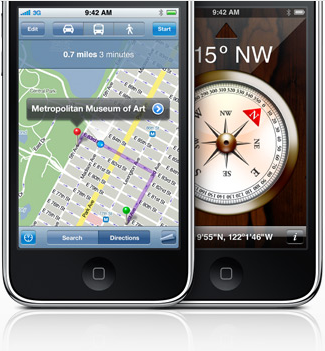
In iPhone OS 3.0, a digital compass will be provisioned, which could potentially add more helpful features to the existing Google Map application. Already, the soon-to-released OakMapper Mobile is taking advantage the open API for Google Map in iPhone SDK 3.0beta to create an application that allow iPhone users to view and report SODs on their iPhones. I believe that the future iteration of the OakMapper Mobile application can take advantage the built-in compass to re-trace the reported SODs.


A downside to sharing historical maps

From the SF Chron: When Google Earth added historical maps of Japan to its online collection last year, the search giant didn't expect a backlash. The finely detailed woodblock prints have been around for centuries, but they show the locations of former low-caste communities. The maps date back to the country's feudal era, when shoguns ruled and a strict caste system was in place. Some surveys have shown that such neighborhoods have lower property values than surrounding areas, and residents have been the target of racial taunts and graffiti. But the modern locations of the old villages are largely unknown to the general public, until these maps were overlain on current street maps.

iPhone SDK 3.0 Previewed

Among all the cool things that you can do with the new iPhone SDK (Software Development Kit) and OS 3.0, I am particularly excited about the release of the Google Map API in the SDK. This will help with webGIS mobile development on iPhone. Check out other features at the iPhone development site. I can't wait to work with the Map Kit framework. I hope it will provide the ability to create markers.

NUS Library: 3D Interactive Map

GIS at its most... creative? Definitely at a micro-scale. Pretty cool project where they have esentially "georeferenced" books within a library by their call numbers.  The shelfs are referenced to an existent CAD model within a GoogleEarth/GIS framework.  The bottom line: lookup a book within the library and this model will take you to the correct shelf on the correct floor, GoogleEarth style.  They also have links like "Laptop Charging Station," "Quite Reading Zone," etc.

Google map driving simulator

 This is a really neat google-earth API -- as in, it uses Google Earth (not Google Maps) capabilities in a web page instead of the stand-alone application. This API is particularly cool because it combine satellite imagery (Google) with ma (Google), with Street view (Google), with oblique aerial photography (Microsoft) all in one view. Anyway, you have to look at it see how cool it is. Notes: 1) A very quick installation of google-earth plugin may be necessary. 2) Click "Create!" button, then "Start," and then just watch. :)

OakMapper 2.0 released

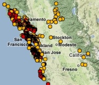
Hi y'all. The new OakMapper 2.0 is up and running, and we'd like your help in mapping areas of oak mortality around the state. Version 2.0 improves upon the website's prior version with increased functionality and additional tools within an easily navigated interface.  Launched by the UC Berkeley Kelly lab in October, OakMapper 2.0 makes it easier for users to explore data, download maps, look at images of oak mortality, and submit suspected locations of oak mortality that may be associated with SOD.  The new interface utilizes the familiar background layers and navigation tools from Google Maps.  Users are able to draw points and polygons directly on the map as well as attach photos to specific points.  The Kelly lab encourages the public to use this site to map suspected cases of SOD and to track their submission by signing up for an account with OakMapper.  Registered users of the site can update their information and make comments on other users' points.  Official confirmations of P. ramorum are clearly separated from community-submitted points and either set of points can be filtered out.The new OakMapper is found at oakmapper.org.  Please consider signing up to be an OakMapper user! The OakMapper was recently featured in the recent journal of the Bay Area Automated Mapping Association

.

KML in Research Competition | Bring your data to life

Google Earth has launched a competition for KML in research, check it out Google is constantly looking for new ways to spur innovation and creativity in science and engineering. We are looking for the best examples of showing your work in Google Earth using KML. And we'll reward the brightest scientists, researchers, and students from all over the world. In addition to prizes, winning entries will be showcased on the Google Earth website and at our booth at the 2008 American Geophysical Union convention

.