LandFire is looking for field data! Add yours now.

I wanted to send out a friendly reminder that the data submission deadline for the current data call is March 31, 2016.  Data submitted before March 31 are evaluated for inclusion in the appropriate update cycle, and submissions after March 31 are typically considered in subsequent updates.  

This is the last call for vegetation/fuel plot data that can be used for the upcoming LANDFIRE Remap. If you have any plot data you would like to contribute please submit the data by March 31 in order to guarantee the data will be evaluated for inclusion in the LF2015 Remap. LANDFIRE is also accepting contributions of polygon data from 2015/2016 for disturbance and treatment activities. Please see the attached data call letter for more information.

Brenda Lundberg, Senior Scientist

Stinger Ghaffarian Technologies (SGT, Inc.)

Contractor to the U.S. Geological Survey (USGS)

Earth Resources Observation & Science (EROS) Center

Phone: 406.329.3405

Email: blundberg@usgs.gov

Our summary from SNAMP: 31 integrated recommendations

The following forest management recommendations consider the SNAMP focal resources (forest, water, wildlife), as well as public participation, as an integrated group. These recommendations were developed by the UC Science Team working together. Although each recommendation was written by one or two authors, the entire team has provided input and critique for the recommendations. The entire UC Science Team endorses all of these integrated management recommendations. Click at the bottom of the post for the full description of each recommendation. 

Section 1: Integrated management recommendations based directly on SNAMP science

Wildfire hazard reduction

1. If your goal is to reduce severity of wildfire effects, SPLATs are an effective means to reduce the severity of wildfires. 

SPLAT impacts on forest ecosystem health 

2. If your goal is to improve forest ecosystem health, SPLATs have a positive effect on tree growth efficiency.

SPLAT impact assessment

3. If your goal is to integrate across firesheds, an accurate vegetation map is essential, and a fusion of optical, lidar and ground data is necessary. 

4. If your goal is to understand the effects of SPLATs, lidar is essential to accurately monitor the intensity and location of SPLAT treatments.

SPLAT impacts on California spotted owl and Pacific fisher

5. If your goal is to maintain existing owl and fisher territories, SPLATs should continue to be placed outside of owl Protected Activity Centers (PACs) and away from fisher den sites, in locations that reduce the risk of high-severity fire occurring within or spreading to those areas.

6. If your goal is to maintain landscape connectivity between spotted owl territories, SPLATs should be implemented in forests with lower canopy cover whenever possible.

7. If your goal is to increase owl nest and fisher den sites, retain oaks and large conifers within SPLAT treatments.

8. If your goal is to maintain fisher habitat quality, retention of canopy cover is a critical consideration.

9. If your goal is to increase fisher foraging activity, limit mastication and implement more post-mastication piling and/or burning to promote a faster recovery of the forest floor condition. 

10. If your goal is to understand SPLAT effects on owl and fisher, it is necessary to consider a larger spatial scale than firesheds.

SPLAT impacts on water quantity and quality

11. If your goal is to detect increases in water yield from forest management, fuel treatments may need to be more intensive than the SPLATs that were implemented in SNAMP.

12. If your goal is to maintain water quality, SPLATs as implemented in SNAMP have no detectable effect on turbidity.

Stakeholder participation in SPLAT implementation and assessment

13. If your goal is to increase acceptance of fuel treatments, employ outreach techniques that include transparency, shared learning, and inclusiveness that lead to relationship building and the ability to work together.

14. If your goal is the increased acceptance of fuel treatments, the public needs to understand the tradeoffs between the impacts of treatments and wildfire.

Successful collaborative adaptive management processes

15. If your goal is to establish a third party adaptive management project with an outside science provider, the project also needs to include an outreach component.

16. If your goal is to develop an engaged and informed public, you need to have a diverse portfolio of outreach methods that includes face to face meetings, surveys, field trips, and web-based information.

17. If your goal is to understand or improve outreach effectiveness, track production, flow, and use of information.

18. If your goal is to engage in collaborative adaptive management at a meaningful management scale, secure reliable long term sources of funding.

19. If your goal is to maintain a successful long-term collaborative adaptive management process, establish long-term relationships with key people in relevant stakeholder groups and funding agencies.

Section 2: Looking forward - Integrated management recommendations based on expert opinion of the UC Science Team

Implementation of SPLATs

20. If your goal is to maximize the value of SPLATs, complete treatment implementation, especially the reduction of surface fuels.

21. If your goal is to efficiently reduce fire behavior and effects, SPLATs need to be strategically placed on the landscape.

22. If your goal is to improve SPLAT effectiveness, increase heterogeneity within treatment type and across the SPLAT network.

Forest ecosystem restoration

23. If your goal is to restore Sierra Nevada forest ecosystems and improve forest resilience to fire, SPLATs can be used as initial entry, but fire needs to be reintroduced into the system or allowed to occur as a natural process (e.g., managed fire).

24. If your goal is to manage the forest for long-term sustainability, you need to consider the pervasive impacts of climate change on wildfire, forest ecosystem health, and water yield.

Management impacts on California spotted owl and Pacific fisher 

25. If your goal is to enhance landscape habitat condition for owl and fisher, hazard tree removal of large trees should be carefully justified before removing.

26. If your goal is to minimize the effects of SPLATs on fisher, SPLAT treatments should be dispersed through space and time.

Management impacts on water quantity and quality

27. If your goal is to optimize water management, consider the range of potential fluctuations in precipitation and temperature.

Successful collaborative adaptive management processes

28. If your goal is to implement collaborative adaptive management, commit enough time, energy, and training of key staff to complete the adaptive management cycle.

29. The role of a third party science provider for an adaptive management program can be realized in a variety of ways.

30. If the goal is to implement adaptive management, managers must adopt clear definitions and guidelines for how new information will be generated, shared, and used to revise subsequent management as needed.

31. If your goal is to increase forest health in the Sierra Nevada, we now know enough to operationalize some of the aspects of SNAMP more broadly.
Read More

SNAMP wrap up: Forest Service should implement proposed forest treatments

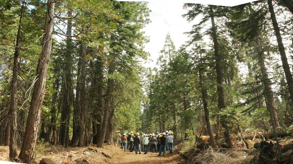
SNAMP field trip: photo from Shufei LeiFull press release: http://ucanr.edu/?blogpost=19857&blogasset=81020

After conducting extensive forest research and taking into consideration all aspects of forest health – including fire and wildlife behavior, water quality and quantity – a group of distinguished scientists have concluded that enough is now known about proposed U.S. Forest Service landscape management treatments for them to be implemented in Sierra Nevada forests. We say:

“There is currently a great need for forest restoration and fire hazard reduction treatments to be implemented at large spatial scales in the Sierra Nevada.”

“The next one to three decades are a critical period: after this time it may be very difficult to influence the character of Sierra Nevada forests, especially old forest characteristics.”

The scientists' recommendation is in the final report of a unique, 10-year experiment in collaboration: the Sierra Nevada Adaptive Management Project (SNAMP). A 1,000-page final report on the project was submitted to the U.S. Forest Service at the end of 2015. In it, scientists reached 31 points of consensus about managing California forests to reduce wildfire hazards and protect wildlife and human communities.

SNAMP – funded with $15 million in grants mainly from the U.S. Forest Service, with support from U.S. Fish and Wildlife, California Natural Resources Agency and University of California – ran from 2007 to 2015. The project ended with the submission of the final report that contains details about the study areas, the treatment processes and reports from each of the six science teams. The science teams and their final reports are:

A key chapter in the publication is titled Integrated Management Recommendations. In it, the 31 points of consensus are outlined.

“The integration in this project is also unique,” Susie Kocher, CE advisor said. “Scientists tend to work in their own focus areas, but we can learn a lot from each other's research projects.”

The Conversation: VTM data helps us understand changes to California forests

I recently adventured into science journalism with a piece describing our recent article in PNAS detailing changes in forest structure over the 20th century. I talk about the use of the old data, and what the implications are for these changes. Check it out!

California’s majestic trees are declining — a harbinger of future forests

By Maggi Kelly, University of California, Berkeley

Scientists in my native state of California were handed a gift: a trove of detailed information about the state’s forests taken during the 1920s and 1930s and digitized over the past 15 years. When we compared this historical data – covering an area bigger than Great Britain – to current forests surveys, we found that California’s famed giant trees are suffering due to drier and warmer conditions.

This change to the forest landscape is important not only to the people of California. Large trees are huge sinks of carbon dioxide, provide habitat for many creatures and play a vital role in the water supply by, for example, providing catchment areas for snow. Forests that are denser with smaller trees are also more likely to burn.

Studying how the structure of forests is shifting over time provides us insight into how forests — a resource we depend on for many environmental and economic reasons — could change in a world of warmer temperatures.

Saved from destruction

Researchers from the University of California at Berkeley and Davis, the Department of Forest Management at the University of Montana, and the US Geological Survey’s California Water Science Center worked together on a paper on California’s forests published last week in the Proceedings of the National Academy of Sciences.

The historical data for our study came from the Wieslander Vegetation Type Mapping (VTM) collection, which was created in the 1920s and 1930s. It’s been described in a 2000 paper as “the most important and comprehensive botanical map of a large area ever undertaken anywhere on the earth’s surface.”

This botanical map was pioneered by Albert Wieslander, an employee of the Forest Service Forest and Range Experiment Station in Berkeley, California. The collection consists of 18,000 detailed vegetation plots, over 200 vegetation maps, 3,100 photographs and hundreds of plant specimens. Overall, the collection covers about 280,000 square kilometers, or just over a third of the state. Combined, the data created a detailed picture of the state’s vegetation in the early 20th century — an important marker ecologists today can use for comparison.

During the 2000s, several groups, including my lab, launched efforts to digitize the plot data, maps and photograph portions of the collection. There still are some missing pieces. Indeed, the journey from paper collection to digital data has been a long one, with several cases in which documents were nearly destroyed either intentionally or by accident. It’s a cautionary tale about the importance of rescued and shared historical data in ecological and geographical analysis.

An example of one of the vegetation maps from the VTM collection. Shufei Lei, photographer


In our large trees study, we wanted to look at forest structure throughout the state by comparing the 1920s and 30s data with contemporary data collected through the Forest Inventory and Analysis (FIA) program. The FIA program is similar to the VTM project: Forest Service crews report on the species, size, and health of trees across all forest land ownerships. Our study was comprehensive, covering the five ecological regions of the state - over 120,000 square kilometers in total – and took into account land-management and land-use history.

Denser forests with more smaller trees

We found that statewide, tree density – or the number of trees in a given area – in forested regions increased by 30% between the two time periods and that forest biomass declined by 19%. This means that there are more smaller trees filling in the forest, while the number of large trees is shrinking. (A large tree was defined as having a diameter larger than 60 centimeters or two feet.)


Wieslander’s photo of French Lake and English Mt. looking north, morphing into 2014 photo by Joyce Gross. Wieslander’s photo shows a large area of barren and semi-barren oak. University of California, Berkeley, CC BY


Also, we found that forest composition in California in the last century shifted toward increased dominance by oaks relative to pines, a pattern consistent with warming and increased water stress. It also fits the shifts in vegetation we can surmise from the paleorecord in California over the last 150,000 years.

Why this shift from fewer large trees to more smaller trees?

Water stress seems to be the best explanation for the pattern we observed. Water stress in a forest is caused by a combination of rising temperatures, which cause trees to lose more water to the air and to earlier melting of snowpacks, which reduces the amount of water available to trees. And indeed, large tree declines were more severe in areas experiencing greater increases in water deficit since the 1930s.

Large trees, in general, seem to be more vulnerable to water shortfalls. This might be because larger, taller trees have trouble getting water to the tops of the trees when water is short, a phenomenon being studied by many tree physiologists.

It might also be that these big trees – some likely 300 years old or more – grew up in a different, colder and moister climate. Regardless of the reasons for large tree decline, we likely can expect more water stress in California from rising global temperatures.

A different forest than what your grandparents saw

Apart from the fact that we tend to love and admire our emblematic large trees, they also serve very important roles in the forests. And changes to forest structure – a shift to fewer large trees and more smaller trees – are important for us to pay attention to.

Forests with large trees store more carbon; groups of larger trees provide preferential habitat for many species; forest structure impacts the way fires burn and impacts the way forests store and release water. These changes are a warning of possible changes to come. The loss of these trees, for example, would take away a massive carbon sink, change the way wildlife use these forests, and change the way they burn.

This photo was taken by Albert Wieslander in 1936 in a redwood grove in San Mateo County. The tree in the front has a diameter around 6 feet. Marian Koshland Biosciences Library


Finally, we would like to stress the importance of rescuing, curating and digitizing historic data. The changes we observed here, although large, did not happen over night – indeed, they really took two or three generations to occur.

Each generation perhaps sees the nature around them as the “normal.” Yet the forests of our grandparents and great-grandparents, observed by the Wieslander crews, were very different than ours today and they will be different again for our grandchildren. We need these historic data to document these changes and demonstrate the rate of change in the natural world.

Some key references:

Jepson, W. L., R. Beidleman, and B. Ertter. 2000. Willis Linn Jepson’s ‘‘Mapping in Forest Botany’’. Madroño 47:269–272.

Kelly, M., B. Allen-Diaz, and N. Kobzina. 2005. Digitization of a historic dataset: the Wieslander California vegetation type mapping project. Madroño 52(3):191-201

Wieslander, A. E. 1935. A vegetation type map of California. Madroño 2:140-144

This article was originally published on The Conversation. Read the original article.

VTM data helps us understand changes to California forests

Some press on our PNAS paper: Twentieth-century shifts in forest structure in California: Denser forests, smaller trees, and increased dominance of oaks.

In the paper we document changes in forest structure between historical (1930s) and contemporary (2000s) surveys of California vegetation. The shorthand is:

  1. Statewide, tree density in forested regions increased by 30% between the two time periods, and forest biomass declined by 19%.
  2. Larger trees (>60 cm diameter at breast height) declined, whereas smaller trees (<30 cm) have increased.
  3. Large tree declines were more severe in areas experiencing greater increases in climatic water deficit since the 1930s.
  4. Forest composition in California in the last century has also shifted toward increased dominance by oaks relative to pines, a pattern consistent with warming and increased water stress, and also with paleohistoric shifts in vegetation in California over the last 150,000 years.

Sierra Nevada Decision Support System

Former student and GIS expert Chippie Kislik alerted me to this video. She is working with others at NASA Ames on a Sierra Nevada DSS Ecological Forecasting Project. A video about the project is here.

The Sierra Nevada contains vital ecosystems that are experiencing changes in hydrologic regimes, such as decreases in snowmelt and peak runoff, which affect forest health and water resources. Currently, the U.S. Forest Service Region 5 office is undergoing Forest Plan revisions to integrate climate-change impacts into mitigation and adaptation strategies. However, there are few tools in place to conduct quantitative assessments of forest and surface conditions in relation to mountain hydrology, while easily and effectively delivering that information to forest managers. To assist the Forest Service, this research team created a Decision Support System (DSS) featuring data integration, data viewing, reporting, and forecasting of ecological conditions within all Sierra Nevada intersecting watersheds.