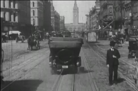
 Sometime before the 1906 San Francisco earthquake, a camera was attached to a streetcar travelling north along Market Street, San Francisco, and recorded the hustle and bustle, the multi-modal transportation options, and the wonderful fashions of early 19th century San Francisco. The movie, which I happend to catch last week at SFMOMA as part of their great (but too large) Stein collection, is mesmerizing. Check it out here on You Tube. It is clearly pre-earthquake, but its exact timing has not been known until now.
 Ferry Building arrivalIn an article in Photogrammetric Engineering and Remote Sensing, Richard Greene narrows the window of aquisition down to between 24 March and 30 March 1906, just weeks before the earthquake on 18 April. Remember, that earthquake and the fires that followed largely destroyed much of the city. He performs this feat of timing through detailed photogrammetry: determing the time of day, the solar position, and the time of year from shadows on cornices and other architectural details.
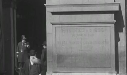 Another windy day in the city! these cornices were helpful in determing solar positionSo cool! The article can be found here. Full reference here:
Greene, R., 2011. Dating the fliming of "A trip down Market Street". Photogrametric Engineering & Remote Sensing 77, 839-848.
Check out some fun pics from the movie.