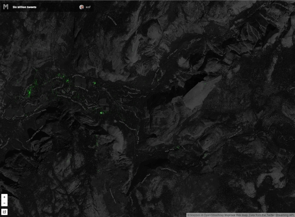
Geo-tagged Tweets in Yosemite


Check out the Geo-tagged tweets in Yosemite Valley.  If you look closely you can see that people are tweeting from the top of Half-Dome, The Mist Trail, Glacier Point, and many parts of Yosemite Valley.  Harnessing this publicly available information may help in understanding what people are thinking and doing in our National Parks.  

All 6 Billion Geo-tagged Tweets are available to view at: https://api.tiles.mapbox.com/v4/enf.c3a2de35/page.html?access_token=pk.eyJ1IjoiZW5mIiwiYSI6IkNJek92bnMifQ.xn2_Uj9RkYTGRuCGg4DXZQ#14/37.7386/-119.5548

New software to extract geographically representative images from Google Street View

New software developed by Carnegie Mellon University in Pittsburgh and INRIA in Paris mines the geotagged imagery in Google Street View to uncover what architectural features distinguish one city from another across the globe. The software is based upon a discriminative clustering algorithm to distinguish features in one picture from another. This research shows that geographically representative image elements can be discovered automatically from Google Street View imagery in a discriminative manner.

Jacob Aron from the New Scientist reports:

"The researchers selected 12 cities from across the globe and analysed 10,000 Google Street View images from each. Their algorithm searches for visual features that appear often in one location but infrequently elsewhere...It turns out that ornate windows and balconies, along with unique blue-and-green street signs, characterise Paris, while columned doorways, Victorian windows and cast-iron railings mark London out from the rest. In the US, long staircases and bay windows mean San Francisco, and gas-powered street lamps are scattered throughout Boston."

"The discovered visual elements can also support a variety of computational geography tasks, such as mapping architectural correspondences and influences within and across cities, finding representative elements at different geo-spatial scales, and geographically-informed image retrieval."

Read the full story by clicking here.

To read the research paper and view the project website click here.
Apple mobile mapping software? coming soon!

We mac users are all a-twitter about the news of an impending Apple mapping software. Here is a sample from NPR:

There's been speculation for months that Apple will try to elbow Google's popular Maps app aside on the iPhone and unveil its own map app, and some of the best evidence yet comes from Tuesday's Wall Street Journal.  The paper looked into the reasons for the impending switch and the broader implications it would have for the smartphone market.  The article continues...

The new software is rumored to be leaner, meaner, and packing a rad 3D visualization capability. It will be unveiled as soon as next week at the annual Apple developer conference in San Francisco.

The evolving privacy debate: Jeffrey Rosen on Fresh Air

Last month in GIS class we had a lively discussion about GIS and privacy. We discussed the idea that while privacy is defined differently in social and legal domains, usually with legal frameworks being a more reactive than prescriptive, at least in the US. But legal and social norms are increasingly shaped by technology: facebook and the like might be pushing the bounds on what is socially acceptable to reveal about yourself, lowering our tolerance for invasions of privacy; smaller GPS make it easier for the police to surveil suspects. Anyway, in a Fresh Air great show, George Washington University law professor Jeffrey Rosen, the co-editor of the new book Constitution 3.0: Freedom and Technological Change, details how technological changes that were unimaginable at the time of the Founding Fathers are challenging our notions of things like personal vs. private space, freedom of speech and our own individual autonomy. It is a fascinating interview:

http://www.npr.org/2011/11/30/142714568/interpreting-the-constitution-in-the-digital-era

A wrap-up of the news surrounding Supreme Court's foray into GPS + privacy

United States vs. Jones raises questions about the limits of police searches, personal privacy and the use of new technology in law enforcement. At issue is whether police need warrants to attach GPS tracking devices to a cars to monitor suspects' movements for indefinite periods of time.

Stay tuned for more analysis. From NPR, some indication that the Supreme Court was not happy with un-warranted GPS tracking. The justices were told police could slap GPS devices on their cars and track their movements, without asking a judge for advance approval.

Also an interesting take from Wired: A number of Supreme Court justices invoked the specter of Big Brother while hearing arguments Tuesday over whether the police may secretly attach GPS devices on Americans’ cars without getting a probable-cause warrant.

While many justices said the concept was unsettling, the high court gave no clear indication on how it will rule in what is arguably one of the biggest Fourth Amendment cases in the computer age. The Obama administration maintains that Americans have no privacy rights when it comes to their movements in public.

Another informative opinion piece from the Washington Post.

Google acquires facial recognition technology company

Missed this earlier, but found it in prep for my privacy and GIS lecture. The article is excerpted here:

Google has acquired a seven-year-old company that develops facial-recognition technology for images and video, though the Web-search giant didn’t say what it plans to do with it.

Regarding face recognition, the spokesman said, “We’ve said that we won’t add face recognition to our apps or product features unless we have strong privacy protections in place, and that’s still the case.”

Google has said it built facial recognition technology for smartphones into a product known as Google Goggles, but withheld it. “As far as I know, it’s the only technology that Google built and after looking at it, we decided to stop,” said Google Chairman Eric Schmidt last month at a conference. “People could use this stuff in a very, very bad way as well as in a good way.”

Google Goggles is pretty sweet, by the way.

Animal tracking with "Smart Collars"

There is an interesting arcticle in today's New York Times about the use of a new breed of animal tracking collars that use on board computers to track valuable information about an animal, beyond location alone.  The new "smart collars" can be used to track when an animal is sleeping, when it is feeding, and lots of other metrics.  The additional data being gathered gives biologists more information to work with while trying to understand the animals habits and needs, in order to provide informed wildlife management decisons.

Awesome (and useful) Mashup Example

We've all seen numerous examples of "mashups", or webmaps containing information from multiple resources, in the past year. Of course, I'm a big fan of the mashup... I'm also a big fan of finding a great mix between form and function, as anyone who's involved with cartographic design can attest to. This mashup appears to have captured this essence quite well, combining simplicity, good cartographic design and decent ergonomics. It's also open source! Oh, and did I mention that it's highly useful?

http://sanfrancisco.crimewatch.org

...and for you East Bay-ers

http://oakland.crimewatch.org/

GPS vs. GPS

There has been some buzz on the blogs about the possibility of smart phones replacing more standard recreational grade GPS devices. This article in the NY Times suggests that the smartphone is beginning to displace the GPS receiver as a convenient way for drivers to get directions to unknown destinations.

Next might be the use of smart phones for non-driving uses of the recreational GPS devices, like geocaching, or science education.  We will be releasing our OakMapper device for the iPhone in September, and will likely be better able to comment on the comparison.

Indigenous mapping network at UC Berkeley

Our friends from DataBasin are on campus on Monday. Kai Henifin is a Cultural Ecologist/GIS Analyst with the non-profit organization Conservation Biology Institute, the developers of DataBasin. Kai will be speaking about "Incorporating Indigenous Knowledge to Improve Conservation through Data Sharing" as part of the Berkeley Indigenous Mapping Network. For more info on the event.

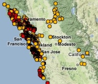
We have some interesting cross-overs with CBI and DataBasin: we added our SOD data to DataBasin recently (see image at left); and CBI have a nice modeling project looking at fisher in the southern Sierra that Reg and Rick are using in their SNAMP work.

iPhone apps for environmental science

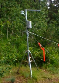
Having just set up a HOBO weather station over the weekend (ain't she pretty?), and being dismayed at having to use my windows computer to control it, I wondered about other ways to monitor the environment.  Amazingly, but perhaps not surprisingly, there are many new iPhone apps out there for us to investigate. 

For example: the recent NPR study about soil moisture monitoring via the iPhone is interesting. The sensors themselves are very expensive, but are monitored via an iPhone app.

Also: this new Wind Meter app, which I am going to test at lunch today. Seems fun, but a far cry from a real anemometer.

And of course: we will soon be releasing our OakMapper iPhone app.

Ghost Maps

There are over 35 million geotagged, time-stamped photos on flickr now. That's enough to start doing some pretty interesting analyses, including this one from Crandall, et al., at Cornell (presented at the WWW 2009 conference, "Mapping the World's Photos" [PDF]).  Not only is it possible to map hot spots of world tourism, but by incorporating the time stamps to map the routes people are taking, you can make out individual streets. As suggested by the Information Aesthetics blog, you could even design popular walking tours.

Once GPS-enabled cameras represent a larger share of the market, flickr may provide data for all sorts of important analyses: tracking SOD, the migration of an endangered song bird, or estimating the "desolation" of a place: the world heat map that the Cornell group presents looks shockingly like the lights at night. The machine... it's ALIVE!!!

iPhone SDK 3.0 Previewed

Among all the cool things that you can do with the new iPhone SDK (Software Development Kit) and OS 3.0, I am particularly excited about the release of the Google Map API in the SDK. This will help with webGIS mobile development on iPhone. Check out other features at the iPhone development site. I can't wait to work with the Map Kit framework. I hope it will provide the ability to create markers.

I Am Here: One Man’s Experiment With the Location-Aware Lifestyle

Matthew Honan's I Am Here: One Man's Experiment With the Location-Aware Lifestyle article in the Wired Magazine details his experiment with geo applications on his location-equipped mobile devices (iPhone and Android):
I wanted to know more about this new frontier, so I became a geo-guinea pig. My plan: Load every cool and interesting location-aware program I could find onto my iPhone and use them as often as possible.
From this experience, he highlights some of the social and security issues that confronts a person who is very "geo-online." The article has references to various geo-applications for the web and mobile devices. It's a good reference article in the proliferation of geo-applications.

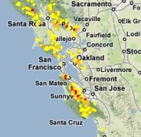
OakMapper 2.0 released

Hi y'all. The new OakMapper 2.0 is up and running, and we'd like your help in mapping areas of oak mortality around the state. Version 2.0 improves upon the website's prior version with increased functionality and additional tools within an easily navigated interface.  Launched by the UC Berkeley Kelly lab in October, OakMapper 2.0 makes it easier for users to explore data, download maps, look at images of oak mortality, and submit suspected locations of oak mortality that may be associated with SOD.  The new interface utilizes the familiar background layers and navigation tools from Google Maps.  Users are able to draw points and polygons directly on the map as well as attach photos to specific points.  The Kelly lab encourages the public to use this site to map suspected cases of SOD and to track their submission by signing up for an account with OakMapper.  Registered users of the site can update their information and make comments on other users' points.  Official confirmations of P. ramorum are clearly separated from community-submitted points and either set of points can be filtered out.The new OakMapper is found at oakmapper.org.  Please consider signing up to be an OakMapper user! The OakMapper was recently featured in the recent journal of the Bay Area Automated Mapping Association

.