Finding old maps online: new resource now available

David Rumsey, with Humphrey Southall (University of Portsmouth) and Petr Pridal (Moravian Library) led a presentation at AAG introducing a new website: oldmapsonline.org. The website's goal is to provide a clearer way to find old maps, and provide them with a stable digital reference. As David says: hundreds of thousands of historical maps have now been scanned and made available on-line by libraries around the world, and this has been a great boon to anyone interested in the history of cartography. However, those interested in the history of the places shown on maps have been less well served: just because a map is "on the web" does not mean we can find the relevant library web site, and even when we find the site the available catalogues are little help in finding maps covering particular places.  A further problem is that even when digitized historical maps have been made available via geo-spatially aware online systems, the resulting references,i.e. the Uniform Resource Locators for accessing the maps, are generally very technology-dependent and unlikely to work even a few years later. The Old Maps Online project provides a universal search portal for historic maps designed to complement rather than compete with libraries' own search interfaces, and also developing best practices for defining persistent Uniform Resource Identifiers for historic maps - URIs not URLs.

Landscape as palimpsest

I am reading a fascinating book this January (xmas gift from the parents) by Jonathan Raban called Driving Home: An American Journey. He is a wonderful writer, and in the introduction he discusses his love of reading, travel and landscapes. He puts all of these into a kind of analytical framework, and discusses how one can observe and consider writing, language, and landscapes as a way to better understand people, context, place and history. Consider this marvelous paragraph:

Trying to understand the habitat in which we live requires an ability to read it - and not just in a loose metaphorical sense. Every inhabited landscape is a palimpsest (this is me now: what an awesome word! see below for definition), its original parchment nearly blackened with the cross-hatching of successive generations of authors, claiming this place as their own and imposing their designs on it, as if their temporary interpretations would stand forever. Later overwriting has obscured all but a few, incompletely erased fragments of the earliest entries on the land, but one can still pick out a phrase here, a word there, and see how the most recently dried layer is already being partially effased with fresh ink.

From wikipedia: A palimpsest is a manuscript page from a scroll or book from which the text has been scraped off and which can be used again. I had not heard of its used as a metaphor for a landscape before, but I like it!
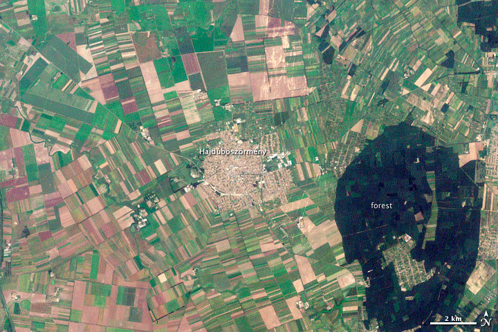
Hajdúböszörmény, Hungary. LandsatYesterday this NASA image post came across my screen as a fitting example of what Raban is talking about. In the  text that accompanies the image, they say "The history of Hajdúböszörmény, Hungary, echoes across its name and over its outline on the land." They go on to discuss the derivation of its name, which echoes past conflicts and local economy, and show how its history is written on the land, in layers of land use. 

"The city is round, a shape easily defended on the flat North Pannonian Plain in northeastern Hungary. The livestock-based economy may also play a role in the shape of the city. The center is densely built, a concentrated ellipse of tan and white. Surrounding the center is a slightly less dense circle, marked by diagonal roads, which held stockyards and gardens. Even today, tiny spots of green indicate that this area contains more open garden space than the city center."

Hooray for geography, landscape history and remote sensing. All fascinating subjects to study. And, I recently found this blogpost from Tim DeChant, former grad student and honorary geographer, in which he describes "ghosts of geography".
Photogrammetry in action: dating the great "A trip down Market Street", 1906

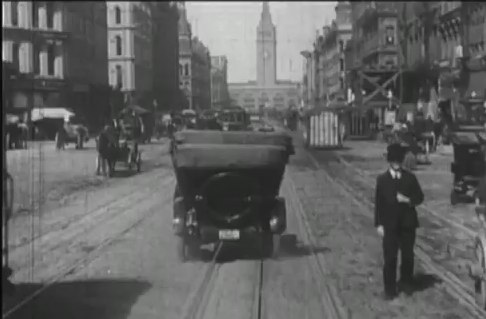
Sometime before the 1906 San Francisco earthquake, a camera was attached to a streetcar travelling north along Market Street, San Francisco, and recorded the hustle and bustle, the multi-modal transportation options, and the wonderful fashions of early 19th century San Francisco. The movie, which I happend to catch last week at SFMOMA as part of their great (but too large) Stein collection, is mesmerizing. Check it out here on You Tube. It is clearly pre-earthquake, but its exact timing has not been known until now.

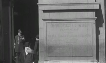
Ferry Building arrivalIn an article in Photogrammetric Engineering and Remote Sensing, Richard Greene narrows the window of aquisition down to between 24 March and 30 March 1906, just weeks before the earthquake on 18 April. Remember, that earthquake and the fires that followed largely destroyed much of the city. He performs this feat of timing through detailed photogrammetry: determing the time of day, the solar position, and the time of year from shadows on cornices and other architectural details.

Another windy day in the city! these cornices were helpful in determing solar positionSo cool! The article can be found here. Full reference here: 

Greene, R., 2011. Dating the fliming of "A trip down Market Street". Photogrametric Engineering & Remote Sensing 77, 839-848.

Check out some fun pics from the movie.


GIS and historical analysis: a good mix

In the new NYT artilce "Digital Maps Are Giving Scholars the Historical Lay of the Land," Patricia Cohen discusses the new academic field known as spatial humanities. Historians, literary theorists, archaeologists and others are using Geographic Information Systems to re-examine real and fictional places like the villages around Salem, Mass., at the time of the witch trials; the Dust Bowl region devastated during the Great Depression; and the Eastcheap taverns where Shakespeare’s Falstaff and Prince Hal caroused.

Mapping spatial information reveals part of human history that otherwise we couldn’t possibly know,” said Anne Kelly Knowles, a geographer at Middlebury College in Vermont. “It enables you to see patterns and information that are literally invisible.”

Fun stuff!

New BAAMA Journal Published

Volume 5, Issue 1 - Spring 2011

BAAMA is pleased to announce The BAAMA Journal has been published in conjunction with Earth Day.  Special thanks to all our contributing authors and editors.  The BAAMA Journal is a publication that highlights Bay Area people and projects that use geospatial technologies.

IN THIS ISSUE:

  • Building Virtual San Francisco: Growing Up With GIS
  • DPW Uses LiDAR and a Custom Algorithm for Delineating Drainage Catchments and Hydrologic Modeling
  • Preparing Historical Aerial Imagery of Southern California Deserts for use in LADWP's GIS
  • Where in the Bay Area


Geospatial Revolution Project launched

Penn State Public Broadcasting has released the first episode of the Geospatial Revolution Project,"an integrated public service media and outreach initiative about the world of digital mapping and how it is changing the way we think, behave, and interact." 

These videos are a great resource for sharing the wonder of all things geospatial in an exciting and easy to understand format. Three additional episodes are set to be published throughout the year. 

View the site to watch the videos and learn more, and keep an eye out for Berkeley's own Kass Green who contributed to the project.

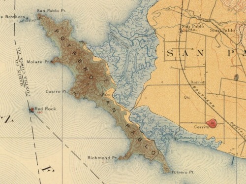
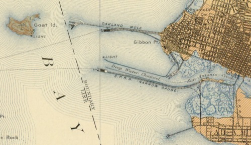
Lovely geologic quads of SF Bay - 1914

This is the bay bridge plan... Goat Island is Treasure Is., there was a narrow gauge railway from Oakland for shipments to SF and beyond.The repository interface with integrated Yahoo! Maps was developed by the Digital Initiatives -- Research & Technology group within the TAMU Libraries using the Manakin interface framework on top of the DSpace digital repository software.

Geologic Atlas of the United States by Texas A & M University Libraries is licensed under a Creative Commons Attribution 3.0 United States License.

The map that changed the world goes digital

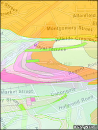
Ancient volcanic rock under EdinburghFor those of you who devoured Simon Winchester's "The Map that Changed the World" about geologist William Smith's journey to create the first geologic map of England and Wales, the first geologic map in the world, this news will please you. (Smith published the 10' x 16' map in 1815. His pivotal insights were that each local outcrop of rock strata was a portion of a single universal sequence of strata and that these rock strata could be distinguished, followed for great distances, and their relative date ascertained by means of imbedded fossilized organisms. His work kick-started the science of geology, and contributed to the theory of evolution. Modified from Wikipedia.)

Now, as the BBC reports, the British Geological Survey's (BGS) has released their new OpenGeoscience portal, which allows the public to study all the UK's geology via a variety of webGIS formats (e.g. Google, and ArcServer). There is a viewer for bedrock geology and the overlying superficial deposits, and another for more geological layers — artificial ground, faults, mass movements, etc.

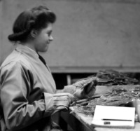
Worker at Pitlochry depot, Perthshire, processing Scottish mica.In a companion effort, the BGS is also releasing images from their historic image archive: 50,000 images are searchable and usable for non-commercial purposes. These images include lovely photography of some of Britain's icons of geology, but also includes image from 100 years ago of miners, explorers, and early 20th century industry.

Reproduced with the permission of the British Geological Survey ©NERC. All rights Reserved


New Interface for the Manhatta Project. Check it.

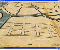
We talked about this before here; and the Manhatta project has a nice new interface for exploring the 1609 map of the island of Manhatta(n), block by block, through time.  I love this project! The combination of mashup, history, design and art are breathtaking.  (And our own Tim Bean worked on reconstructing the early topography! - see his comment below.) Go Fullscreen on your 30"-monitor. I dare you.

“The goal of the Mannahatta Project has never been to return Manhattan to its primeval state. The goal of the project is discover something new about a place we all know so well, whether we live in New York or see it on television, and, through that discovery, to alter our way of life. New York does not lack for dystopian visions of the future…. But what is the vision of the future that works? Might it lie in Mannahatta, the green heart of New York, and with a new start to history, a few hours before Hudson arrived that sunny afternoon four hundred years ago?”

- from Mannahatta: A Natural History of New York City

A downside to sharing historical maps

From the SF Chron: When Google Earth added historical maps of Japan to its online collection last year, the search giant didn't expect a backlash. The finely detailed woodblock prints have been around for centuries, but they show the locations of former low-caste communities. The maps date back to the country's feudal era, when shoguns ruled and a strict caste system was in place. Some surveys have shown that such neighborhoods have lower property values than surrounding areas, and residents have been the target of racial taunts and graffiti. But the modern locations of the old villages are largely unknown to the general public, until these maps were overlain on current street maps.

Repro ancient boats

I've been a sucker for these stories of people re-building sailing and exploring craft based on 1,000-year old plans ever since my parents gave me  Kon-Tiki to read as an impressionable youth. Maybe it is why I love such riduculous Hollywood tripe like the 13th Warrior.

Now comes this news item: A replica 16th Century junk has sunk off Taiwan, one day short of completing an epic voyage to the US and back (see article). One day short of finishing! And you know why? They were, in BBC lingo, "rammed in two" by a freighter (there is a photograph). The 54ft-long (16.5m) Princess Taiping, powered only by cotton sails on three masts, was designed according to ancient specifications. Like the original Kon-Tiki, the raft used by Norwegian explorer and writer Thor Heyerdahl in his 1947 expedition across the Pacific Ocean from South America to the Polynesian islands. (Amazingly, there is a you tube video). Both expeditions set out to prove that folks other than the usual suspects could have made it here and back earlier than we thought.

There was another, similar, high-profile event with the building and sailing of the "Sea Stallion" Viking ship, which made the journey from Denmark to Ireland in 2007, fully blogged. The entries started with hopeful titles like "Building a Viking warship" and "the ship is launched", and quickly turned shorter and grimmer, with "a rough first night" and "hypothermia strikes" and "hampered by the weather" and "false hope"... suggesting 1) that Vikings were, perhaps not surprisingly, very hardy, and 2) reasons why they didn't have time to leave detailed on-voyage journals.

Still, I guess this stuff appeals to the same part of me that loves old maps, and that is the purported link to the blog.

Rad! Mapping Manhattan Project

Manhattan in 1609 Eric Sanderson is visiting CNR next week: Chris G pointed me to his work. Imagining Manhattan before European contact through visualization. Gorgeous work, and appealing on many levels for geographers everywhere.  Project site, and highlights from the New Yorker.  The image here shows an aerial view of Manhattan as it might have looked in 1609, juxtaposed with the outline of Manhattan today.

Schiaparelli’s Beautiful Canali

Sciaparelli’s Canali For those of you without at least a passing interest in Martian cartography, Giovanni Schiaparelli was one of the first astronomer's to map Mars using a halfway decent telescope. He drew exceedingly detailed maps of what he saw, depicting massive, linear trenches he called canali. He firmly believed these were too straight to be formed by any natural process, and that they must have been artificially produced by inhuman minds (perhaps even cool and unsympathetic ones). His maps were the state of the art for about 20 years. BibliOdyssey has a wonderful post showing some of Schiaparelli's maps, which are far more beautiful than I had imagined, having previously only seen crude reproductions in 2-tone print. Wonderful stuff. Via The Map Room

The VTM photo-hunt is on (at least in the Bay Area)

I am reinvigorating the mission to re-shoot the VTM photos. At least in the Bay Area. This was prompted by the recent Berkleyan article about the new UC reserve in Santa Clara County ("preserves oak-woodland ecosystem at urban/wildland interface"). I thought "I wonder if there are any pictures of the area from the VTM collection?" and had a search this weekend. Sure enough, there are some nice ones. So I've geo-located a few from around the bay to get us started. Any ideas on: automating the process; making an easy site to upload paired photos; an easy way to link Township/Range queries into gmaps... Any volunteers to do Santa Cruz County? Lots of great pics there. And check out the local logging history documented in the photos of the New Almaden quad.