New OSGeo-Live GIS software collection released

OSGeo-Live is a self-contained bootable DVD, USB flash drive and Virtual Machine based upon Ubuntu Linux that is pre-configured with a wide variety of robust open source geospatial software. The applications can be trialled without installing anything on your computer, simply by booting the computer from the DVD or USB drive. The lightening overview introduces all these applications, and hence provides a comprehensive introduction to the breadth of Geospatial Open Source.

http://live.osgeo.org

Highlights
50 Quality Geospatial Open Source applications installed and pre-configured
Quality free world maps and geodata
One page overviews and quick start guides for all applications
Overviews of key OGC standards
Translations for Greek, German, Polish, Spanish and Japanese

Contents

Browser Clients

  • OpenLayers - Browser GIS Client
  • Geomajas - Browser GIS Client
  • Mapbender - Geoportal Framework
  • MapFish - Web Mapping Framework
  • GeoMoose - Web GIS Portal

Crisis Management

  • Sahana Eden - Disaster management
  • Ushahidi - Mapping and Timeline for events

Databases

  • PostGIS - Spatial Database
  • SpatiaLite - Lightweight Database
  • Rasdaman - Multi-Dimensional Raster Database
  • pgRouting - Routing for PostGIS
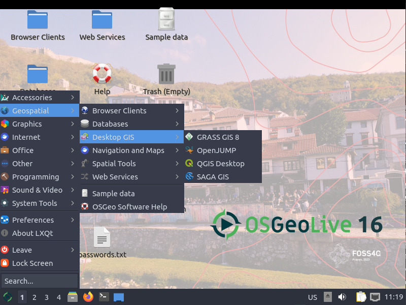

Desktop GIS

  • Quantum GIS (QGIS)
  • GRASS GIS
  • gvSIG Desktop
  • User-friendly Desktop Internet GIS (uDig)
  • Kosmo Desktop
  • OpenJUMP GIS
  • SAGA
  • OSSIM - Image Processing
  • Geopublisher - Catalogue
  • AtlasStyler - Style Editor
  • osgEarth - 3D Terrain Rendering
  • MB-System - Sea Floor Mapping

Navigation and Maps

  • GpsDrive - GPS Navigation
  • Marble - Spinning Globe
  • OpenCPN - Marine GPS Chartplotter
  • OpenStreetMap - OpenStreetMap Tools
  • Prune - View, Edit and Convert GPS Tracks
  • Viking - GPS Data Analysis and Viewer
  • zyGrib - Weather Forecast Maps


Spatial Tools

  • GeoKettle - ETL (Extract, Transform and Load) Tool
  • GDAL/OGR - Geospatial Data Translation Tools
  • GMT - Cartographic Rendering
  • Mapnik - Cartographic Rendering
  • MapTiler - Create Map Tiles
  • OTB - Image Processing
  • R Spatial Task View - Statistical Programming


Web Services

  • GeoServer
  • MapServer
  • deegree
  • GeoNetwork - Metadata Catalogue
  • pycsw - Metadata Catalogue
  • MapProxy - Proxy WMS & tile services
  • QGIS Server - Web Map Service
  • 52°North WSS - Web Security Service
  • 52°North WPS - Web Processing Service
  • 52°North SOS - Sensor Observation Service
  • TinyOWS - WFS-T Service
  • ZOO Project - Web Processing Service


Data

  • Natural Earth - Geographic Data Sets
  • OSGeo North Carolina, USA Educational dataset
  • OpenStreetMap - Sample extract from OpenStreetMap


Geospatial Libraries

  • GeoTools - Java GIS Toolkit
  • MetaCRS - Coordinate Reference System Transformations
  • libLAS - LiDAR Data Access


Other software of interest (not available Live)

  • MapWindow GIS - Microsoft Windows based GIS
  • MapGuide Open Source - Web Service

troubling report of OSM vandalism

From Sarah. This is a troubling story from ReadWriteWeb reporting that someone at a range of Google IP addresses in India has been editing the collaboratively made map of the world in some very unhelpful ways, like moving and deleting information and reversing the direction of one-way streets on the map.

Update: Google sent the following statement to ReadWriteWeb on Tuesday morning. "The two people who made these changes were contractors acting on their own behalf while on the Google network. They are no longer working on Google projects."

A Google spokesperson told BoingBoing on Friday that the company was "mortified" by the discovery - but now it appears the same Google contractor may be behind mayhem rippling throughout one of the world's biggest maps. Google says it's investigating these latest allegations.

MIT releases new Urban Network Analysis Tool for ArcGIS 10

The MIT City Form Research Group recently released a new open-source plugin for ArcGIS 10 to perform advanced spatial analyses on network data such as urban street networks. The tool can give researchers a better understanding of how the spatial layout of cities and their social, economic, and environmental processes affect the way people live in it.

The tool measures reach, gravity, betweenness, closeness, and straightness on spatial networks. This means you can assess the number of services or resources within a certain walking distance and can analyze the volume of traffic along sidewalks and streets. Like other network analysis tools, the tool evaluates network element geometry and distance and distinguishes between shorter and longer links. What is unique about this tool is that it not only operates with node and edge elements like other network analysis tools, but it can also incorporate additional network elements such as buildings. Individual buildings or objects can be characterized within spatial networks and can be weighted to give more or less influence. For example, more populated buildings can be set to have a greater impact on results. The tool can also be used to assess urban growth and change.

Click here for the press release.

Open Street Map's further integration into commercial mapping products

MapQuest has recently announced the opening of a secondary beta open source mapping website based on the Open Street Maps engine where community members can post and edit map data that will then be integrated into Open Street Maps and MapQuest products. The announcement also indicates MapQuest may in the near future merge this beta open source map portal with their commercial map portal. The integration of community based map editing and open source data in commercial products has started to become a trend in the commercial mapping world. Other commercial map products such as Microsoft Bing and commercial mapping applications such as ESRI ArcGIS 10 base maps already offer Open Street Map as a product to view alongside their propriety map data. Community led commercial map editing is not entirely new as Google and other map services already allow account members to point out errors and make corrections. What is different in the case of MapQuest is the integration of open source data with commercial data. This continues to push the boundaries of community led mapping and the further proliferation of open source data products in the commercial and public spheres.

Read the full article here.

Open MapQuest Beta

QGIS 1.6 'Copiapó' released

The folks working on Quantum GIS (QGIS) have recently released a new version of their popular open source desktop GIS application that works on Windows, Mac, and Linux. 

Version 1.6 can now be downloaded from qgis.org via http://download.qgis.org.

There are a lot of new features and bug fixes in this version, adding even more power to use QGIS as a viable analysis platform.  You can read the entire list of new features here.

Be sure to check out the included analysis plugins for:

  • OGR Converter: Convert between more than 30 vector formats, including shapefile, kml, mapinfo, gpx...
  • Interpolation: Interpolate vector data using Triangular Interpolation (TIN) or Inverse Distance Weighting (IDW)
  • Raster Based Terrain Analysis: Convert DEM data to Slope, Aspect, Ruggedness, or Total Curvature
  • Spatial Query: Topological operations include contains, equals, intersects, touches...
  • GDAL Tools: Adds a new drop down list to your menu that includes many GDAL functions like warp, translate, or contour.  This adds a lot of the power of GDAL without the need to write scripts.
  • fTools: Adds a new dropdown list to your menu with many geoprocessing and analysis functions such as buffers, joins, nearest neighbor, vector grid creation...
  • GRASS: Adds a suite of tools that allow you to use much of the GRASS functionality within the QGIS application

If you are relatively new to GIS, and would like to try QGIS, we've just added an introductory tutorial to the GIF's Quick Start Guides based on this latest software release.  Check out the pdf and accompanying data for Introduction to QGIS: Basic geoprocessing and making a map layout


corridor analysis tools

Alan shared a link with me for Corridor Design. It includes downloads for various GIS Tools, overviews of corridor concepts, and reports on linkage designs. The stated goal is "to transfer everything we've learned about designing wildlife corridors to the general public to facilitate better conservation, science, and dialogue."  Check out the site's blog for info on their latest projects.

New: Geospatial Modelling Environment

If you're a fan of Hawth's tools, be sure to check out SpatialEcology.com's latest product, Geospatial Modelling Environment.

"It combines the power of the statistical software R with the geographic processing functionality of ESRI ArcGIS to drive geospatial analyses.

"It incorporates most of the functionality of its predecessor, HawthsTools, but with some important improvements. It has a greater range of analysis and modelling tools, supports batch processing, offers new graphing functionality, automatically records work-flows for future reference, supports geodatabases, and can be called programatically." - http://www.spatialecology.com/gme/

The volunteer mappers who helped Haiti

Using an image slideshow, BBC News tells the story of how volunteer mappers used OpenStreetMap, an open source mapping platform, to construct a detailed map of Port au Prince in Haiti with layers of geographic information. The geographic information was accessed and used by the rescue personel on the ground. This short slideshow highlights the importance of PPGIS/webGIS, mobile GIS, open source/platform, crowdsourcing, and public participation in a critical situation like the rescue effort in Haiti.

To view the slideshow, please click here.

OakMapper 2.0 released

Hi y'all. The new OakMapper 2.0 is up and running, and we'd like your help in mapping areas of oak mortality around the state. Version 2.0 improves upon the website's prior version with increased functionality and additional tools within an easily navigated interface.  Launched by the UC Berkeley Kelly lab in October, OakMapper 2.0 makes it easier for users to explore data, download maps, look at images of oak mortality, and submit suspected locations of oak mortality that may be associated with SOD.  The new interface utilizes the familiar background layers and navigation tools from Google Maps.  Users are able to draw points and polygons directly on the map as well as attach photos to specific points.  The Kelly lab encourages the public to use this site to map suspected cases of SOD and to track their submission by signing up for an account with OakMapper.  Registered users of the site can update their information and make comments on other users' points.  Official confirmations of P. ramorum are clearly separated from community-submitted points and either set of points can be filtered out.The new OakMapper is found at oakmapper.org.  Please consider signing up to be an OakMapper user! The OakMapper was recently featured in the recent journal of the Bay Area Automated Mapping Association

.

Global disease alert map

healthmap.JPG Here is yet another exciting use of the GoolgeMaps API.... HealthMap aggregates outbreak data by disease from numerous sources (news, personal accounts, and official alerts) and displays them by location in real-time. It's a collaborative project brought together by the Harvard-MIT Division of Health Sciences and Technology. If you're not a germaphobe now, you may become one after taking a look at the map; be sure to check it out before your next international trip or even if you stay around here. For example, did you know that the West Nile Virus has infected 78 people in California this year? Even closer to home, there was a TB scare at Kaiser in SF last week.

After Google (Maps), What?

"After Google, What?" was the name of a course at the iSchool, but Paul Smith of EveryBlock has asked the same of Google Maps. His answer? An open source web mapping stack. Check out his cool article on A List Apart, "Take Control of Your Maps". If you haven't checked out EveryBlock, do so. Their maps are beautiful. We use a lot of these technologies in the lab and in the GIIF, with the exception of Mapnik, which, to my shame, I've tried and failed to install. Update Some responses: a thread on geowanking including a response from Google evangelist Pam Fox, and discussion and response from the author on ALA (for some reason the post isn't on Technorati yet...).

Animal Tracking via SMS

Google Maps Mania posted about this interesting use of free web services to track deer. A collar on the deer sends SMS messages to an e-mail account, which creates blog posts that are used to populate a database, which in turn feeds a map. I'm particularly interested in this integration of SMS messaging for mapping, especially after hearing Deborah Estrin speak yesterday. Such methods open up huge opportunities for participatory projects.

Brian Hamlin’s Portfolio

For those of you who attended Bernt Wahl's geolunch talk about context-based neighborhood mapping, you may remember Brian Hamlin. Brian is assisting with the programming side of the project. Toward the end of the geolunch talk, Brian displayed some of his work with various open-source GIS disciplines, including OpenLayers, PostGIS and FeatureServer . He's recently put together a portfolio that summarizes his work nicely ... I thought I'd share it with you all. He welcomes comments and suggestions sent to maplabs AT light42 DOT com.

Volunteered Geographic Information (VGI)

In addition to the volunteer computing, distributed thinking, and coordinated activities that David Anderson discussed at the Feb. 8th Geolunch, Volunteered Geographic Information is a growing form of "Citizen Cyber-Science." OpenStreetMap and Wikimapia are the most well-known examples of VGI, an emerging process in which citizens voluntarily create and combine spatial data for maps and mash-ups. I went to a talk last week by Rutgers Professor David Tulloch. He gave an overview of an interesting VGI site that was developed to let citizens help map vernal pools in New Jersey. Examples of other VGI projects and presentations on the ethics, reliability, and potential of VGI can be found on the Workshop on VGI site which includes info collected from an event held at UCSB last December. Also of interest is a site that provides the information presented at a Workshop on Agent-Based Modeling of Complex Spatial Systems. The talk was hosted by the Cal's Department of Landscape Architecture and Environmental Planning, which will be hosting upcoming events on topics such as the SF green spaces, National Parks, and EU ecological policies .

Some of David Anderson’s Citizen Cyber-Science websites

Dave's talk last week for Geolunch was AWESOME. Here are some of the sites he mentioned. Get started with your distributed computing and thinking people! SETI@Home Climateprediction.net Stardust@Home Distributed Proofreaders Rosetta@Home Just to summarize, they have 500k active participants and 700k computers making up about 2 PetaFLOPS of juice.

Mikel Maron’s blog: building digital technology for our planet

Here find another related blog: Brainoff.com. Mikel is an advocate of open collection and distribution of geographic data, particularly with OpenStreetMap the "free and openly editable map of the entire world". Using Wiki concepts and GPS units, They are rapidly mapping using entirely voluntary contributions.  There are some great examples of participatory mapping on this site, among many other interesting ideas.