GIF Bootcamp 2017 wrap up!

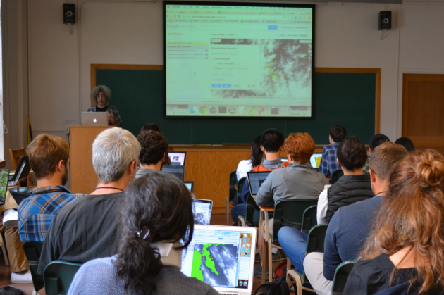
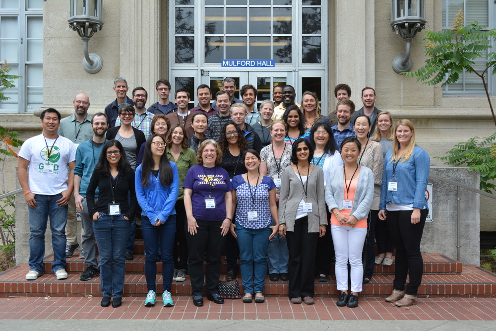
Our third GIF Spatial Data Science Bootcamp has wrapped!  We had an excellent 3 days with wonderful people from a range of locations and professions and learned about open tools for managing, analyzing and visualizing spatial data. This year's bootcamp was sponsored by IGIS and GreenValley Intl (a Lidar and drone company). GreenValley showcased their new lidar backpack, and we took an excellent shot of the bootcamp participants. What is Paparazzi in lidar-speak? Lidarazzi? 

Here is our spin: We live in a world where the importance and availability of spatial data are ever increasing. Today’s marketplace needs trained spatial data analysts who can:

  • compile disparate data from multiple sources;
  • use easily available and open technology for robust data analysis, sharing, and publication;
  • apply core spatial analysis methods;
  • and utilize visualization tools to communicate with project managers, the public, and other stakeholders.

At the Spatial Data Science Bootcamp we learn how to integrate modern Spatial Data Science techniques into your workflow through hands-on exercises that leverage today's latest open source and cloud/web-based technologies. 

Bootcamp is here! Spatial Data Science 2016

Spatial Data Science for Professionals

We live in a world where the importance of spatial data is ever increasing. Many of the societal challenges we face today — fire response, energy distribution, efficient resource allocation, land use, food scarcity, invasive species, climate change, privacy and safety — are associated with big spatial data.  Addressing these challenges will require trained analysts fluent in:
  • integrating disparate data, from aircraft, satellites, mobile phones, historic collections, public records, the internet;
  • using easily available and open technology for robust data analysis, sharing, and publication;
  • understanding and applying core spatial analysis methods;
  • and applying visualization tools to communicate with project managers, policy-makers, scientists and the public.

Mastering these challenges requires Spatial Data Science: big data tools, geospatial analytics, and visualization. Today’s marketplace needs trained analysts who know how to find, evaluate, manage, analyze and publish spatial data in a variety of environments. With this hands-on Spatial Data Science Bootcamp for professionals, you can expand your GIS skill level and learn how to integrate open source and web-based solutions into your GIS toolkit by gaining an understanding of spatial data science techniques.

The goal of this Spatial Data Science Bootcamp is to familiarize participants with the modern spatial data workflow and explore open source and cloud/web based options for spatial data management, analysis, visualization and publication. We’ll use hands-on exercises that leverage open source and cloud/web based technologies for a variety of spatial data applications.

https://iep.berkeley.edu/spatial/iep-spatial-bootcamp-overview

Spring 2016 GIF Workshops

Spring 2016 GIF Workshops 

The Geospatial Innovation Facility is excited to announce that we will be offering our standard workshops series for FREE this spring to UC Berkeley students, faculty, and staff. Currently we still need to retain our pricing of $224 for all non-UC affiliates. However, space is limited and the workshops will be filled on a first-come first-served basis, so register today at to take advantage of these great training opportunities!

GIF workshops offer hands-on applications oriented training in a variety of geospatial topics. Our Introduction to Geographic Information Systems (GIS) and Introduction to Remote Sensing workshops are designed for participants with little to no experience in GIS, or those who would like to refresh their geospatial skills. Each workshop teaches core geospatial principals and techniques through a combination of lecture and hands-on interactive activities.  

We are currently accepting registration for our introductory series of workshops offered over the next several weeks. See more detailed descriptions and register for any of the upcoming trainings at: http://gif.berkeley.edu/support/workshops.html

January 29: Intro to GIS: Social Science Focus

The presentation will get you up to speed on what kind of analyses GIS may be used for, as well as the basic structures of spatial data. After the lecture you will follow an interactive exercise that has been designed to introduce you to ArcGIS Desktop software while analyzing street and census data around the City of Berkeley.

February 5: Intro to GIS: Environmental Science Focus

The presentation will get you up to speed on what kind of analyses GIS may be used for, as well as the basic structures of spatial data. After the lecture you will follow an interactive exercise that has been designed to introduce you to ArcGIS Desktop software while analyzing environmental data from around Lake Tahoe.

February 12: Intro to Open Source GIS: Using QGIS

QGIS is a free and open source geospatial desktop application that has been developing at a rapid pace. Its ease of use and accessibility (available for PC, Mac, and Linux platforms) has created a strong and active user community. In this workshop, we will explore the basic functionality of QGIS so that you may quickly learn how to load and format vector and raster data, edit shapefiles, and query attributes. 

February 19: Intro to GIS for Agriculture: Rangeland Focus

An introductory presentation will get you up to speed on what kind of analyses GIS may be used for, as well as the basic structures of spatial data. After this brief lecture you will follow an interactive exercise that will introduce you to using free and open source online data to analyze and map rangelands in the California Central Valley.

February 26: Intro to Remote Sensing: Understanding Digital Imagery

This workshop introduces basic principles of understanding digital imagery, both satellite and aerial. Through a combination of lecture and interactive activities, we will explore what makes up a multi-spectral image, where to find and download them, and how to view and manipulate imagery.

These workshops are held in 124 Mulford Hall and run from 1pm – 4:30pm. Sign-up now for this great opportunity for intensive, hands-on training in geospatial methods, tools, and analysis!

New job opening @ Berkeley: geospatial informatics program coodinator

Academic Coordinator III Position

The University of California, Division of Agriculture and Natural Resources (UC ANR), Informatics and Geographic Information Systems (IGIS) Program is seeking a Statewide Program Coordinator for both local and statewide program development and delivery. The IGIS Statewide Program seeks to provide innovation, technology, training, and data support for UC ANR’s research and extension mission through the collection, analysis and visualization of geospatial data. We are interested in developing and delivering data-driven tools, research results, and training to support UC ANR Strategic Initiatives: Endemic and invasive pests and diseases, Healthy families and communities, Sustainable food systems, Sustainable natural ecosystems, and Water quality, quantity and security.

The program coordinator will help fulfill the goals of the IGIS Program by facilitating the delivery of research, training, and data support to the UC ANR network. We are looking for a highly specialized academic who will provide vision and leadership on geospatial data resources, analysis and visualization that will serve multiple scientific constituencies at the state and national level. These data resources include: sensor networks, ecological datasets, existing statewide research databases, web-based data frameworks such as APIs, open data collections, and remote sensing collections. 

This is a unique academic position within the University of California that allows for intellectual growth, interaction with multiple scientists and academics, and the development of impactful datadriven solutions to California’s agricultural and natural resource challenges. 

If you have questions, you can email me: maggi@berkeley.edu

Websitehttp://ucanr.edu/Jobs/Jobs_990/?jobnum=894

Closing Date: December 31, 2015

Job Description: Download
Download Application: Word | PDF

Minimum and Required Qualifications:

  • A PhD Degree in Ecology, Geography, Agriculture, Statistics, or an appropriate related field with experience in data science, geographic information sciences, remote sensing, or ecological informatics is required. 
  • Experience synthesizing large ecological or socio-ecological datasets and using them in complex local and statewide research projects is required. 
  • Experience developing and managing research projects including agriculture, ecology, or climate change is required. 
  • Experience using GIS, remote sensing, and/or web programming software is required. 
  • The ability to communicate and extend technical information in an understandable manner is required. 
  • Strong leadership, administration, financial, and management skills are required. 
  • Knowledge of human relations is required including the ability to work with people with a diversity of views and values, to motivate people and adapt to changing situations.


GIS Day Wrap Up (a bit late...)

GIS Day 2015! Happy 10th Birthday to the GIF! 

Panel of mapping innovators @ GIS Day 2015

A quick look at the past decade:

The GIF began in November 2015 on a wave of excitement around geospatial technology. In the months leading up to our first GIS Day in 2005, Google Maps launched, then went mobile; Google Earth launched in the summer; and NASA Blue Marble arrived. Hurricane Katrina changed the way we map disasters in real time. The opening up of the Landsat archive at no-cost by the USGS revolutionized how we can monitor the Earth's surface by allowing dense time-series analysis. These and other developments made viewing our world with detail, ease, and beauty commonplace, but these were nothing short of revolutionary - spurring new developments in science, governance and business. The decade since then has been one of intense innovation, and we have seen a rush in geospatial technologies that have enriched our lives immeasurably.

As 2015 ends we can recognize a similar wave of excitement around geospatial technology as we experienced a decade ago, yet one that is more diverse and far reaching than in 2005. This GIS Day we sought to highlight the societal benefit derived from innovators across academia, non-profits, government, and industry. 

GIS Day/GIF 10th Anniversary

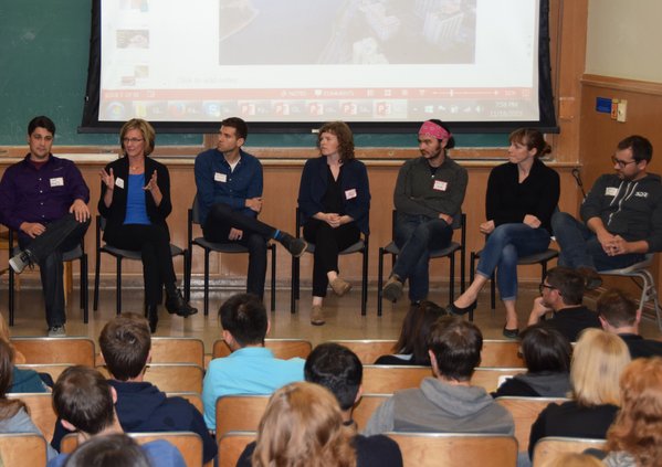
On November 18 we co-hosted GIS Day with BayGeo (formerly BAAMA) as we have in the past and had well over 180 attendees. Our GIS Day featured posters, lightening talks, presentations, and a panel session that included local innovators from Bay Area Industry, Government, and Non-Profits. Our panel speakers included: Cindy Schmidt (NASA); Gregory Crutsinger (3D Robotics); Karin Tuxen-Bettman (Google); Ken-ichi Ueda (iNaturalist); Sara Dean (Stamen Designs); Jeffrey Miller (GeoWing); and Kyle Brazil (Urthecast). The discussion included what skills they look for in recruiting and where they see the geospatial world going in the next 5 years. It was a fun evening and personally, I learned a ton. Many levels of appreciation go out to those who spoke, those who came, and those who helped make the day happen. 

Hold the date! January 15th for a workshop on Open Tools with ESRI

On January 15th we will hold a full day free workshop on Open Mapping Tools using ESRI. 

Welcome to the Esri GeoDev HackerLab. This is an eight-hour, mentored, hands-on lab for developers (novice or experienced) where you will learn how to build maps and apps for the web, devices, and desktops using ArcGIS and other technologies. 

Here is what we will cover:

1. A brief intro to ArcGIS Online for developers. Get the free dev subscription and we put the tools right into your hands.

2. Data: Search, find, connect to, import, edit, collect, translate, convert, and host datasets and web services. You will also use a variety of cloud-based geoanalytical tools to make better sense of the data and export new datasets for your apps to use.

3. Design: Create web maps tailored to the needs of your end users using layer selection, thematic rendering, popups, and more.

4. Develop: Build customized apps with or without code, using templates, builders, APIs, and SDKs, from Esri and from other popular open source technologies.

The labs are divided into modules that you can do in any order. Choose ones you want to learn, and skip those you already know. You can bring your own data or use tutorial data that we provide. Use web maps of your own or build ones on-site during the lab. If you are a coder, dig into APIs and SDKs from Esri or compatible open source libraries. If you aren’t a coder, you can still build highly customized production-ready apps using templates and builders.

The tutorials are going to be led by developers from Esri, who will either guide you along the way or assist you as you choose your own learning path. 

Stay tuned for sign-up information!

Upcoming FREE GIF workshops

The GIF is highlighting 2 brand new workshops in the upcoming weeks. Because these are the first time we've done these sessions, I'm happy to announce that we are offering them free of charge to UC Berkeley students, researchers, faculty, and staff. The workshop seats will be filled on a first come first serve basis. Space is limited, so please register at: http://gif.berkeley.edu/support/workshops.html 

New Workshop: Intro to Geospatial Analysis using R 

This new workshop is designed for participants who are already familiar with GIS and spatial analysis concepts who are interested in using R. The presentation will introduce attendees to major spatial packages and concepts within the R environment. We will step through hands-on exercises exploring tools and methods for analyzing environmental data within R, and supply information for participants to continue their exploration of these methods in their own research projects.

Location: 124 Mulford Hall

Day: Friday, November 20th 

Time: 1:00-4:30 pm 

New Workshop: Web GIS and Mobile Data Collection using ArcGIS Online

This workshop is designed for participants with little to no GPS, GIS or web mapping experience. The workshop will include an interactive exercise that will have you building your own mobile data collection survey to be used with your Smartphone GPS. You will then see how this survey application seamlessly integrates with ArcGIS Online to create a web map that displays the survey results in real time.This course content is the result of a collaborative effort between UC ANR IGIS Statewide Program, and the UC Berkeley, Geospatial Innovation Facility (GIF)

Location: 124 Mulford Hall

Day: Friday, December 4th 

Time: 1:00-4:30 pm 

Register for these new training opportunities today! Space will fill up quickly, so make sure you register soon if you are interested. Also, feel free to pass this email onto your colleagues who may also be interested. If you have any questions, contact Nancy Thomas at nethomas@berkeley.edu.

2005-2015: A decade of intense innovation in mapping

The GIF began in November 2015 on a wave of excitement around geospatial technology. In the months leading up to our first GIS Day in 2005, Google Maps launched, then went mobile; Google Earth launched in the summer; and NASA Blue Marble arrived. Hurricane Katrina changed the way we map disasters in real time. The opening up of the Landsat archive at no-cost by the USGS revolutionized how we can monitor the Earth's surface by allowing dense time-series analysis. These and other developments made viewing our world with detail, ease, and beauty commonplace, but these were nothing short of revolutionary - spurring new developments in science, governance and business. The decade since then has been one of intense innovation, and we have seen a rush in geospatial technologies that have enriched our lives immeasurably. In November 2015 we can recognize a similar wave of excitement around geospatial technology as we experienced a decade ago, one that is more diverse and far reaching than in 2005. This GIS Day we would like to highlight the societal benefit derived from innovators across academia, non-profits, government, and industry. Our panel discussion on the 18th has representatives from several local innovators in the field, including: Stamen Designs, Geowing, PlanetLabs, 3D Robotics, NASA, iNaturalist.org, and Google, who will discuss their perspectives on the boom in Bay Area mapping. 

Please think about joining us at GIS Day!

http://gif.berkeley.edu/gisday.html

GIS Day 2015! Happy 10th Birthday to the GIF

Please join us for GIS Day 2015!  

You are all welcome to visit us at the Geospatial Innovation Facility for this year’s GIS Day Celebration on Wednesday, November 18th. This year’s event is co-hosted by the GIF and BayGeo (formerly the Bay Area Automated Mapping Association, or BAAMA). 

Not only are we celebrating all things geospatial for GIS Day, we are also celebrating the GIF’s 10th year anniversary! The GIF was formally started at a GIS Day event in 2005. As in previous years, we will be having a poster session, many exciting talks, and refreshments. It is a great time to network and catch up with what is going on with mapping around the SF Bay Area. 

Instead of a Keynote talk, this year we will be holding a Plenary Session in the early evening with local innovators from Bay Area Industry, Government and Non-Profits (including Stamen, PlanetLabs, Google, 3DRobotics, GeoWing, iNaturalist, and NASA) who all focus on state-of-the-art geospatial technology and solutions. The discussion will cover such topics as what skills they look for in recruiting, where they see the geospatial world going in the next 5 years, and how we can better partner around the bay to stay at the forefront of the geospatial revolution.

GIS Day is free and open to the public but we do request that you RSVP, so we know how many participants to expect! Also, we are inviting the geospatial community to participate in GIS Day during our poster, lightening talk, and presentation sessions.  If you’d like to present your work or display a poster, please indicate your interest on the RSVP form. Our RSVP form allows you to register your poster or to be considered for a presentation slot. Please include the title and a brief abstract for your proposed poster or talk on that form. Topics are open to anything geospatial! If you’d like to attend GIS Day 2015, please RSVP here: http://goo.gl/forms/3mj30lc6eS


What: GIS Day 2015 @ the GIF

Location: Mulford Hall, UC Berkeley

Date: Wednesday, November 18th

Time: 5pm – 8:30pm

Google Earth Engine @ the GIF!

Students, researchers, mappers, and big data enthusiasts took place in an exciting 2 day Google Earth Engine workshop this last week hosted by the GIF and the Google Earth Engine Team. We had an exiting overview of the latest and greatest research adventures from Google by Kelly lab alum Karin Tuxen-Bettman including advances in some of what Google Earth Outreach team is involved in...

As well as new/upcoming ventures

The Earth Engine team led some great tutorials getting people well versed in JavaScript and using the Earth Engine playground, and Earth Engine API. Having beginner and advanced workshop tracks during the two day event allowed for both broad and deep participation from researchers across the Berkeley campus. Take a look at the packed agenda and more

here!

We also had a stellar panel of UC Berkeley professor Jeff Chambers and graduate students Sophie Taddeo, Alexander Bryk, and Lisa Kelley who shared an intimate view of how they were using Earth Engine in their research. The panel shared stories of using Earth Engine to evaluate disturbance in tropical forests, map the movement of wetlands, and meandering rivers, as well as looking at agroforestry systems in Indonesia through a socio-ecological lens.

Thanks to Google and the Earth Engine Team for guiding, the GIF for hosting, and all of the participants for engaging in an action packed two days!

Spatial Data Science @ Berkeley May 2015

Bootcamp participants outside historic Mulford HallOur bootcamp on Spatial Data Science has concluded. We had three packed days learning about the concepts, tools and workflow associated with spatial databases, analysis and visualizations. 

Our goal was not to teach a specific suite of tools but rather to teach participants how to develop and refine repeatable and testable workflows for spatial data using common standard programming practices.

On Day 1 we focused on setting up a collaborative virtual data environment through virtual machines, spatial databases (PostgreSQL/PostGIS) with multi-user editing and versioning (GeoGig). We also talked about open data and open standards, and modern data formats and tools (GeoJSON, GDAL).

Analyzing spatial data is the best part! On Day 2 we focused on open analytical tools for spatial data. We focused on one particular class of spatial data analysis: pattern analysis, and used Python (i.e. PySAL, NumPy, PyCharm, iPython Notebook), and R Studio (i.e. raster, sp, maptools, rgdal, shiny) to look at spatial autocorrelation and spatial regression. 

Wait, visualizing spatial data is the best part! Day 3 was dedicated to the web stack, and visualization. We started with web mapping (web stack, HTML/CSS, JavaScript, Leaflet), and then focused on web-based visualizations (D3).  Web mapping is great, and as OpenGeo.org says: “Internet maps appear magical: portals into infinitely large, infinitely deep pools of data. But they aren't magical, they are built of a few standard pieces of technology, and the pieces can be re-arranged and sourced from different places.…Anyone can build an internet map."

All-in-all it was a great time spent with a collection of very interesting mapping professionals from around the country (and Haiti!). Thanks to everyone!

10-year anniversary for the GIF

I'm musing, contemplating and writing on the decade 2005-2015, as this is the GIF's 10-year anniversary. What a decade it was. Here I'll post and add to some of the key events that helped transform mapping (and the GIF) in the last 10 years.

Key background events

  • 1996. Mapquest launched.
  • 1997. Skynet becomes self-aware.
  • May 2000. Selective Availabilility on GPS turned off, leading the way for GPS in smartphones.
  • The Scan Line Corrector (SLC) on the Landsat 7 ETM+ instrument failed May 31, 2003.
  • 2004. Open Street Map founded.
  • March 2004. Yahoo! maps launched, first slippy maps (click and drag to pan and zoom the map).
  • 2004. NASA releases WorldWind.
  • October 2004. Google acquires Where 2 allowing AJAX map tiling to a desktop client.
  • October 2004. Google acquires Keyhole.

What made 2005 such a crazy year

  • Google Maps launches in February, and goes mobile in April.
  • The first mashup: Paul Rademacher's Housingmaps.org. His original post on Craigslist asking for feedback: https://forums.craigslist.org/?ID=26638141
  • Google Maps API launches in June.
  • NASA's Blue Marble Next Generation released.
  • Google Earth launches in June.
  • Hurricane Katrina hits in August. Simple webmaps for the disaster proliferate, and ESRI and GE get on the scene.
  • Kellylab's first blog post in September.
  • GIF launches and hosts our first GIS Day in November with Michael Jones, formerly of Keyhole.
  • The back-up solar array drive on Landsat 5 began failing and was not able to provide the power needed to charge the batteries. November 26.

Where we are in 2015

We've gone through a number of transitions in the world of mapping:

  • Data have transitioned from being siloed, and found in clearinghouses to being open and provided through APIs.
  • We’ve moved from desktop computing to cloud computing.
  • Webmaps have transitioned from using proprietary stacks to networks with multiple open and proprietary options.
  • We’ve moved from imagery gathered monthly or seasonally to daily; footprints are smaller, and our focus has shifted from local focus to global coverage.
  • Our planimetric 2D view is changing with lidar and radar sensors.
  • Visualization has moved from static cartography or simple animations to dynamic interactive visualization.
  • Finally, mapped content is no longer anonymous or regulated, but highly personal and narrative.

Key GIF milestones:

  • 2005 GIIF (Geospatial Imaging and Informatics Facility) launches
  • 2006 OakMapper changes from ArcIMS to Google Earth API
  • 2008 GIIF becomes GIF
  • 2008 OakMapper 2.0 launches
  • 2008 SNAMP website launches
  • 2011 Cal-Adapt goes live
  • 2013 EcoEngine/HOLOS goes live
  • 2014 LandCarbon launches
  • 2014 GIF and Cal-Adapt go to the White House
  • 2014 vtm.berkeley.edu goes live, built from the HOLOS API
  • 2015 Spatial Data Science bootcamp in May

Onwards and upwards!