Bing map layers now available in ArcGIS applications
/ESRI and Bing Maps (formerly Microsoft Virtual Earth) have recently developed a seamlessly integrated solution to view Bing’s aerial, road, or hybrid data as a base map in ArcGIS applications. These layers are the same that can be viewed via Bing Maps web interface offering a huge variety of imagery throughout the world including very high resolution sources.
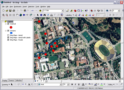
The layers are easily integrated into ArcMap by adding the .lyr files from ESRI’s website to any project. These small .lyr files may be saved on your hard drive and accessed just like any other layers that you have stored locally. In order to use these layers, however, you will need to have the latest version of ArcMap (9.3.1) installed, and a new license must be installed as described in the link. For those of you connecting through UC Berkeley’s license server, you will be happy to know that this license update has already been made.