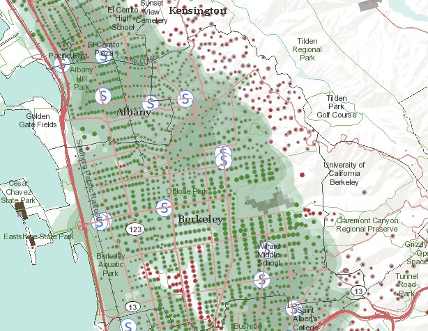
ESRI Food Desert Mapping
/Also from Greeninfo Network. Team ESRI, publisher of ArcGIS software, has rolled out “The Food Desert Finder” a terrific interactive map which shows where there are gaps in access to supermarkets. If access to nutritious food is limited or made difficult by factors such as cost or the distance traveled to obtain it, peoples’ health suffers – these areas that lack relatively easy access to nutritious, affordable food as popularly known as “food deserts.” The ESRI Food Desert Finder is a searchable map that shows populations in poverty who live beyond a one mile walk to a supermarket and who lack other access to healthy fresh foods.
 Berkeley/Kensington area, CAHere is a snap from the Berkeley/Kensington area. Obviously, something more than just walking distance to supermarkets is critical, as the Kensigton area (showing all the red dots - indicating people without easy access to grocery stores) is not known as an underserved community. Still a very nice tool, and one which will be used by our OurSpace project.